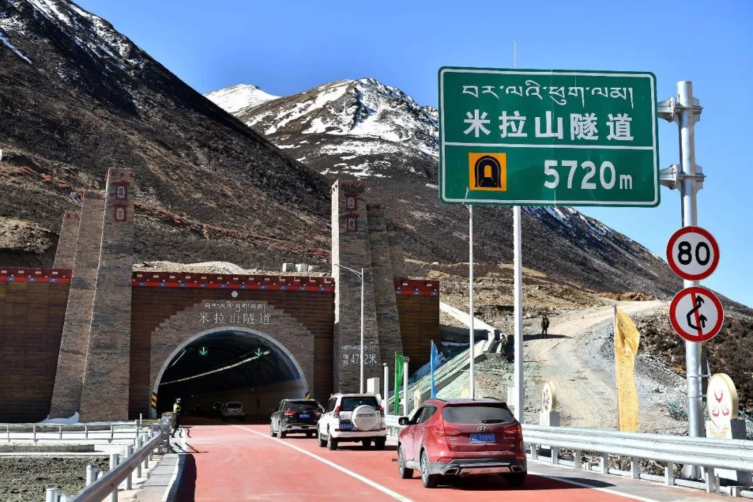
Vehicles enter the Mila Mountain Tunnel (Photo by Xinhua News Agency reporter Li Xin)
do you know?
April 26 at 10:00 am
The world’s highest highway tunnel
——The Mira Mountain Tunnel is officially open to traffic in both directions!
In the future, a one-way drive to and from Lalin
The original 8 hours will be shortened to 4 hours
Saved half the time! sprinkle flowers~
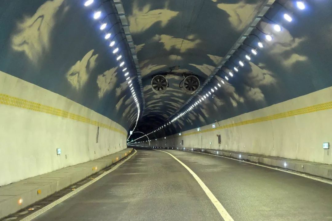
The interior scene of the Mila Mountain Tunnel (Photographed by Xinhua News Agency reporter Li Xin)
However, as soon as the news
There is a public article saying:
Mira Mountain Tunnel opens to traffic
It means that the Mira Mountain Pass will become history
Before that, once a tunnel was repaired,
There is an article that says “318 Sichuan-Tibet Line is about to disappear…”
Ummm
I’m afraid you have misunderstood something!
Let’s talk about it today
1
mira hill
The last snow mountain before reaching Lhasa on National Highway 318
Boundary Mountains in Lhasa and Nyingchi
Watershed between Lhasa River and Niyang River
Before the altitude of Dongda Mountain (5130m) is not corrected
Mila Mountain Pass at an altitude of 5013 meters
It has always been the highest on the 318 line
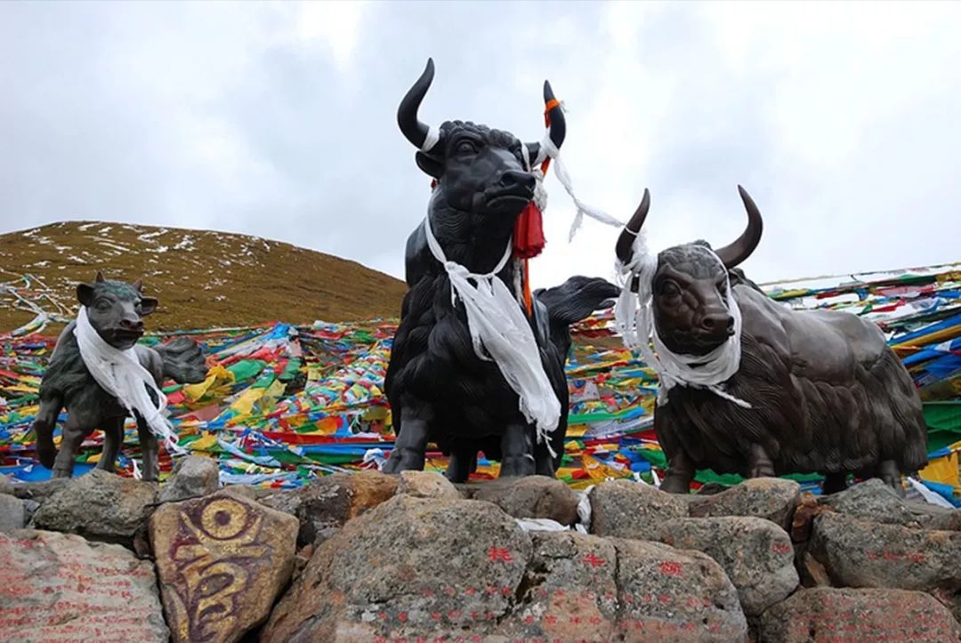
A marker on the Mira Pass. Photography/VagrantDway
Basically from winter to May and June every year
It snows on the top of Mira Mountain, when it is heavy
The traffic jam on National Highway 318 is particularly serious
After the opening of the Mira Mountain Tunnel
All these problems can be solved
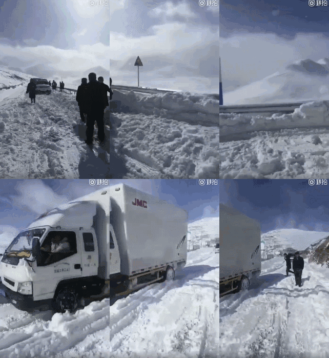
In February 2018, there was heavy snow at the pass of Mira Mountain, and I couldn’t bear to look directly at it
However
What we need to figure out is:
The Mira Mountain Tunnel is not on National Highway 318
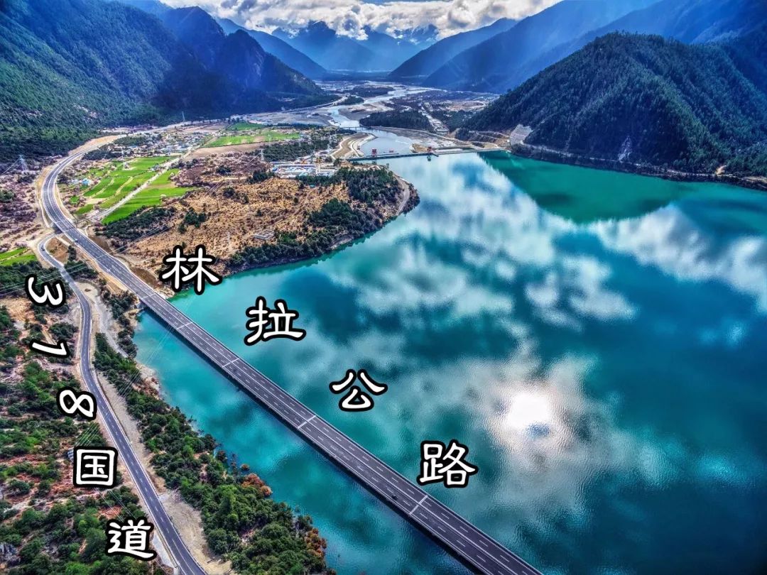
Background Image Source/Linzhi Tourism Development Committee
Major news points out:
“The Mila Mountain Tunnel was officially opened to traffic,
It marks the opening of the Linla high-grade highway to traffic. “
Strictly speaking, “Linla Expressway” is
Reconstruction project of Nyingchi-Lhasa Highway on National Highway 318
But in fact it has set aside the original 318 National Road
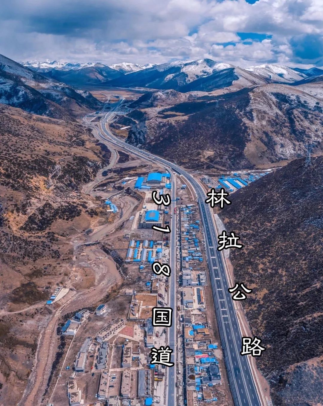
Background Image Source/Linzhi Tourism Development Committee
this high-grade highway
Almost parallel to Linla section of National Highway 318
Not only can it relieve the traffic pressure of 318 in the Linla section
Take the “Linla Expressway”
It will be 4 hours faster than the old road!
The new line has no coverage relationship with 318
Everyone can choose which way to go according to the situation
So the Mira Mountain Tunnel opens to traffic
It does not mean the disappearance of the Mira Pass
2
Everyone’s worries are not without reason
Previously
The old pass through the tunnel on Line 318
Some continue to be maintained as backup lanes
Others are abandoned and deserted, quietly retreating
It is regrettable
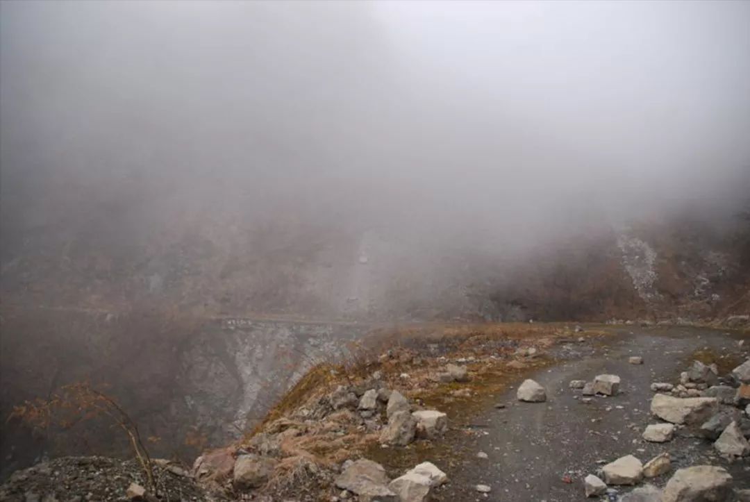
There was no one to clean up the fallen rocks on the old road at the pass of Erlang Mountain. source/emrejiong
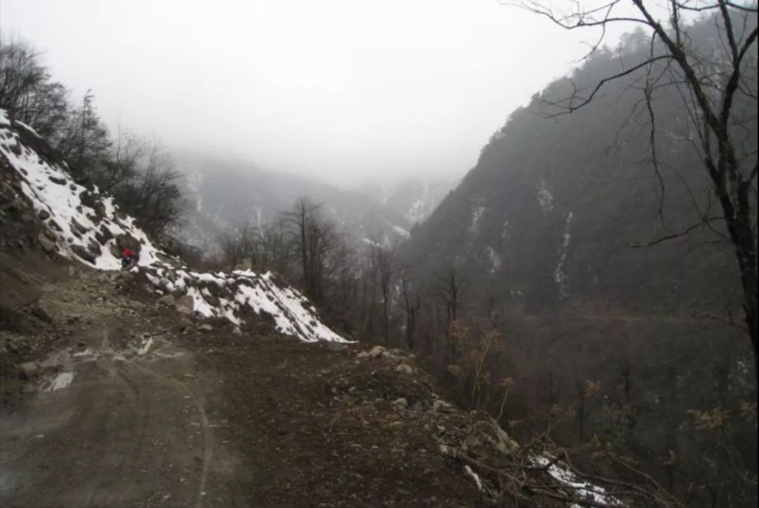
landslide . source/emrejiong
“Chinese National Geographic” once said:
“If we say that the winding peaks
It is a majestic long poem
Then, the pass hidden among the peaks
It is the poetic eye that goes deep into the psalms . “
“Usually, a pass means the divergence of two rivers and the intersection of two mountains. The rolling mountains are like endless barriers-they block the way from the plain to the plateau, and these natural The appearance of the pass often forms a unique traffic artery from one to the other , and these passes are not only the natural dangers of the road, but also the paradise with beautiful scenery. ”——《China National Geographic》
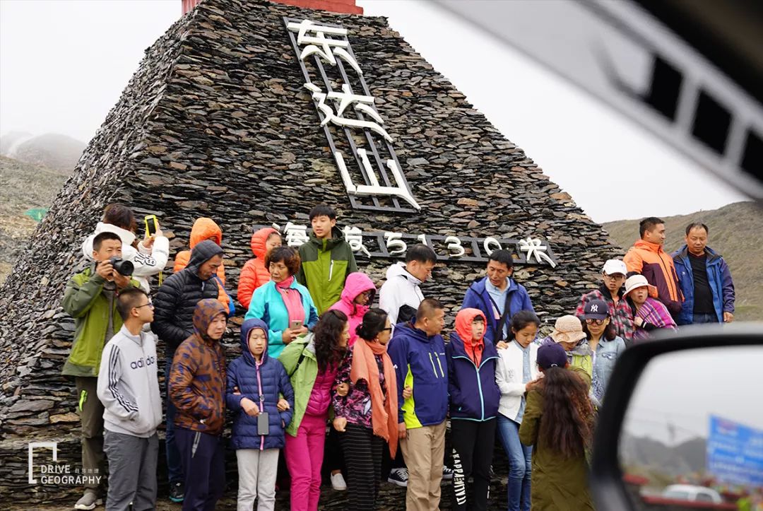
The pass is a holy place to take pictures, and many times you have to queue up
For self-drivers
Take 318 and miss these high-altitude passes
There is no sense of challenge, no talk of bragging
There is no “best viewing platform”
(In other words, the scenery and viewing platforms are still there, but we can’t go up some of them)
“It is convenient to have a tunnel, but for those who go to Tibet to see the scenery, it is still interesting to drive through the pass. Although the road is difficult and takes a long time, the scenery is beautiful after all, and it is worth it!” – Netizen “Blue Moon” once left a message road.
But a coin has two sides
The meaning of the existence of the tunnel
for safer and faster
Reduce the impact of rain and snow on the road
there is no doubt
It is also the only way for national defense combat readiness channel 318
“It’s much faster to go through the tunnel. Although there are less scenery, there must be more people going there, which can promote the local economy. With the development of the economy, some old and difficult problems in the past will be easily solved.” – Netizen” hebrew”
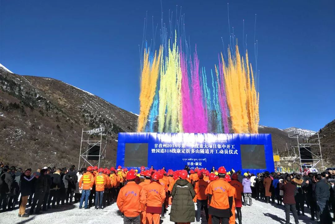
On March 29, 2018, the mobilization ceremony for the start of construction of the Kangding Zhedoshan Tunnel of National Highway 318.
Today, Zheduoshan and Haizishan tunnels
under construction
As more and more tunnels are built in the future
The road to Tibet
It will be faster and better than we imagined
However, the construction of a tunnel
At least 4 to 5 years
We have to wait for the completion of all 14 Daxueshan passes on the 318 line
it’s too early to talk
What’s more, not all old roads are abandoned
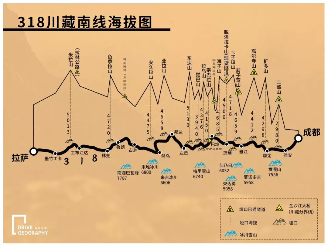
Let’s take stock
Which passes on the 318 line have been repaired through the tunnel
Which old roads can still run
3
1. Erlangshan Tunnel, the earliest completed (2001), the first high-altitude tunnel in China, the altitude of the pass: 2980 meters
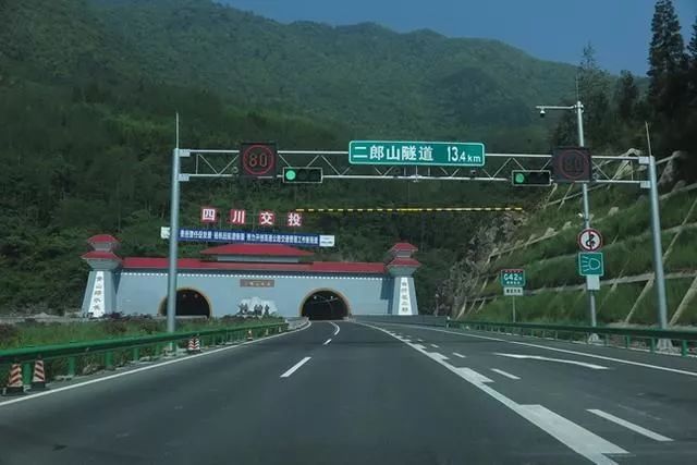
A blink of an eye
The repair distance from the Erlangshan Tunnel
It’s been 18 years
In the past, we often said that it was difficult to enter Tibet.
The first barrier from the mainland to the Qinghai-Tibet Plateau
Erlang Mountain
(It’s Zheduo Mountain now)
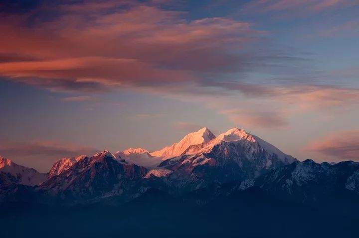
The morning of Erlang Mountain. Photography/Ye Zhenglin
Erlang Mountain
It belongs to the southern extension of the Qionglai-Jiajin Mountains
It is the north-south boundary mountain between Ganzi Tibetan Autonomous Prefecture and Ya’an City
It is the first mountain pass on the 318 Sichuan-Tibet South Line
at the same time
It is also a natural watershed between Qingyi River and Dadu River
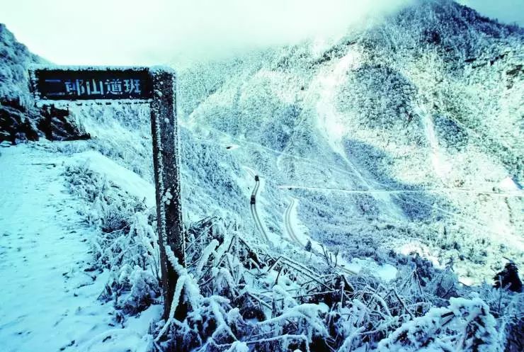
Twenty years ago, the road to cross Erlang Mountain was long and difficult. There are curves, narrow roads, and many landslides; the weather is changeable, and rain and snow come at any time; traffic can only be opened during the day, and one-sided clearance is required. Every month, vehicles with odd numbers enter the mountain and vehicles with even numbers leave the mountain. It is normal to be able to cross Erlang Mountain within two days, but it is difficult to say in rainy and snowy weather. At that time, the driver who was traveling on the Sichuan-Tibet line said that Erlang Mountain changed his face. Photography/Zhang Jinneng
1950s
The People’s Liberation Army built mountains and roads here
There is also a road-building song that is widely known to everyone:
Er, Erlang Mountain is so high, so high
Dead trees and wild grass all over the mountains
Boulders all over the hill
Difficult to walk on the narrow path
Anti-Japanese War traffic was blocked by him which one was blocked by him
…
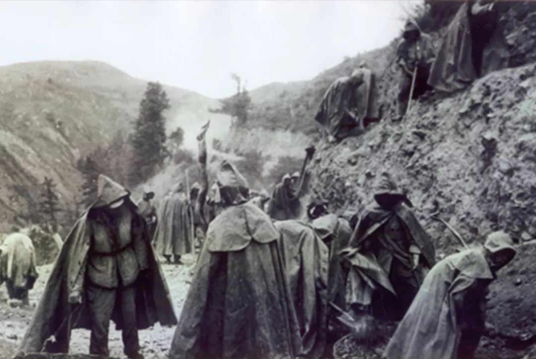
In 1950, the road was built in the rain on Erlang Mountain in Tianquan
Erlang Mountain in 1999
The 4,176-meter-long super-long tunnel was opened
avoid the most dangerous road
Since then Erlang Mountain is no longer a natural barrier
After the opening of the tunnel
All-weather two-way driving
The mileage of the road section is shortened by 25 kilometers
Reduce travel time by 3 hours
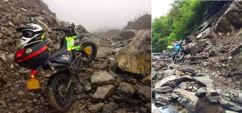
ps. The old road leading to the pass has been abandoned for many years, and cars can no longer get on it. However, many motorcycle friends and riders went to “expedition”. However, some netizens barely drove up from the Luding side (the Tianquan side has been cut off), and stopped at Yakou.

2. Gaoersi Mountain Tunnel, started construction in 2011 and opened to traffic in early 2016, pass altitude: 4412 meters
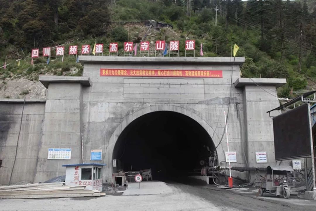
Mount Gaoersi
Located between Xindu Bridge and Yajiang River
The old road is also a famous dangerous road on the 318 line
If Zheduo Mountain is the first pass in Kham
Then it is the second level of Khamba
Many road sections slope horizontally
Known as “carp back”
Large trucks are not easy to balance
To avoid overturning, you must drive on the hillside lane
Cars can only “give way”
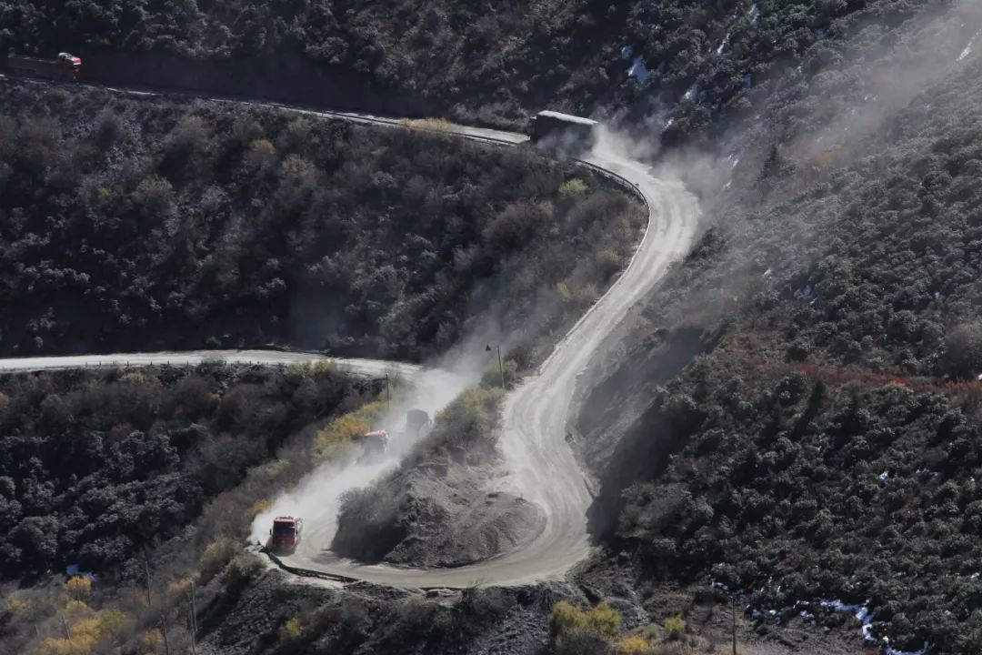
Yakou looks back at the way he came. Source/Public Account: Sichuan-Tibet Travel Network
Because of the old road downhill, the road is on the dark side
in winter
Severe ice and snow roads and dark ice
Scratch scratch traffic accidents almost every day
heavy traffic jam
After the tunnel was repaired, the new road down the mountain was changed to the sunny side
Pass the Zhonggu Nongba 1 Bridge, 2 Bridge and Wolong Temple Bridge all the way
Detour through the river valley along the bridge
Successfully avoided the 3 kilometers of shady dangerous road section
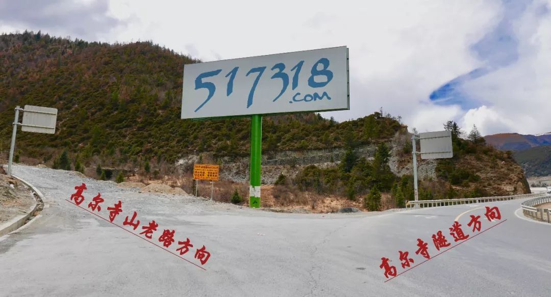
*500 meters ahead of K2927, ⬅️ is the old road of Gaoer Temple Mountain, ➡️ is the direction of Gaoer Temple Tunnel, source/public account: Sichuan Tibet Travel Network
Xinpanshan Road, the highest altitude is 3948 meters
The height difference from the old road is about 400 meters
The new road still needs to go up the mountainside through the Panshan Highway
The scenery of blue sky, white clouds and mountains is still there
Total mileage saved nearly 25 kilometers
Time saving over 1 hour
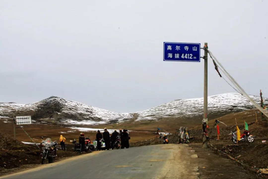
just no longer can be viewed through
The pass between Yala Mountain and Gongga Mountain
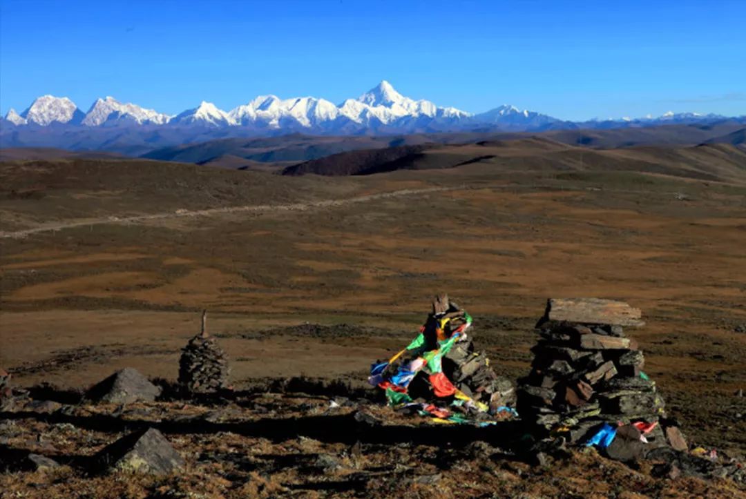
After turning over the pass, there is a left-turning fork road, and there is a black stone city more than ten kilometers ahead. The terrain is open and the best viewing platform for Gongga Snow Mountain. Photography / Huaishuzi

3. Jianziwan Mountain Tunnel, opened to traffic in 2015, pass altitude: 4659 meters
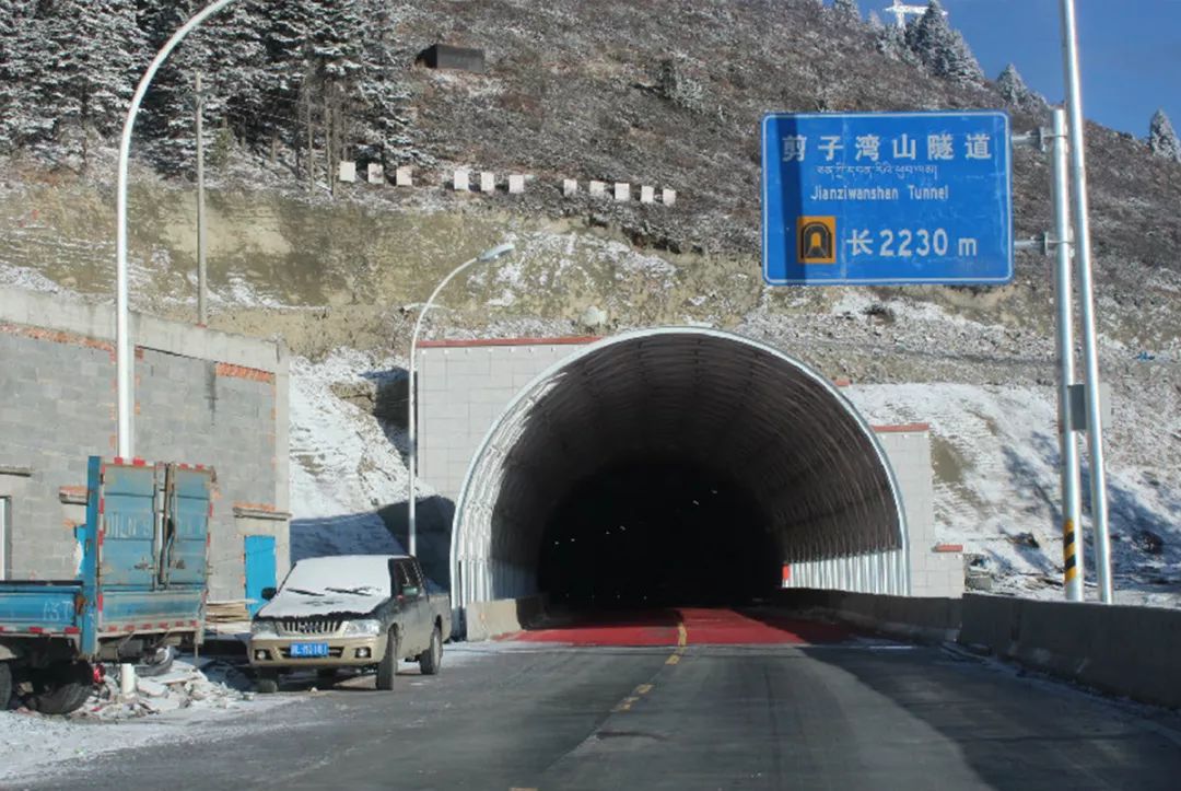
Photography/Cryogenic 78
scissors bay mountain
Shaluri
Located on the west side of Shanggezong Township, Yajiang County, Sichuan Province
The watershed between Yalong River and Jizhu Valley
It is named because it climbs over its post road and bends into a scissors shape next to the mountain.
The Tibetan name “Bolanggong” means the top of the mountain that is foggy all day
Standing on the pass overlooking the
Look at thousands of mountains and ravines, overlapping peaks
When luck is good, the strong wind will push away the lingering clouds and mists
Glance at the Gongga sacred mountain in the distance
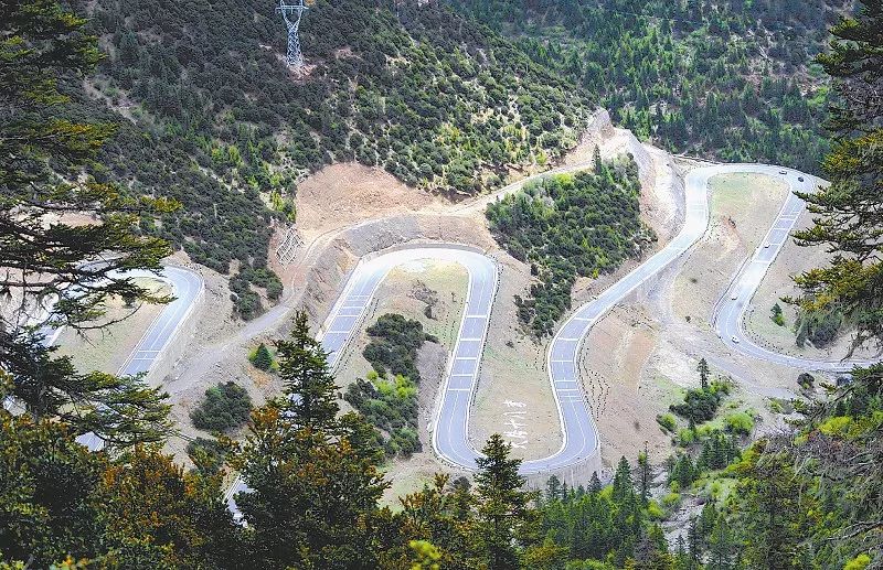
At the Observation Deck at Yakou, overlooking the way down the mountain, the big characters “Eighteen Bends of Tianlu” appear in front of you. Photographer/Reporter: Heng Changhui
Scissor Bay Mountain in Tibetan mythology is very sacred
Legend has it that when the third Dalai Lama returned from a pilgrimage through hardships,
His mount Shenyang is tired
Just rest on this mountain
God sheep brings luck to local people
Tibetans with a radius of hundreds of miles
Since then, Jianziwan Mountain has been worshiped as a sacred mountain.
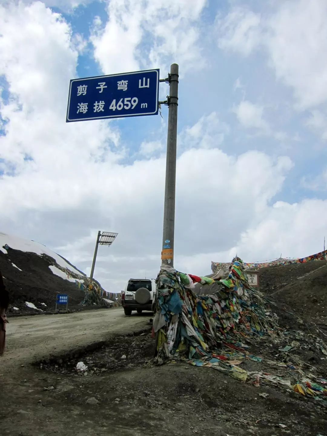
Photography / Li Li dimples
but compared to the myth
Here is the 102K section called “ghost beckoning”
On the contrary, it made Jianziwan Mountain Pass famous far and wide.
Rugged road with multiple consecutive sharp turns
Passing drivers all have sweaty palms
There have been serious traffic accidents that killed more than 10 people
2014 is the historical node of Jianziwan Mountain
Tunnel opened to traffic
You can climb the Scissors Bay Mountain in a few minutes
Say goodbye to “ghost beckoning”

4. Tolorakashan Tunnel (Litang Tunnel), opened to traffic in 2015, pass altitude: 4500 meters
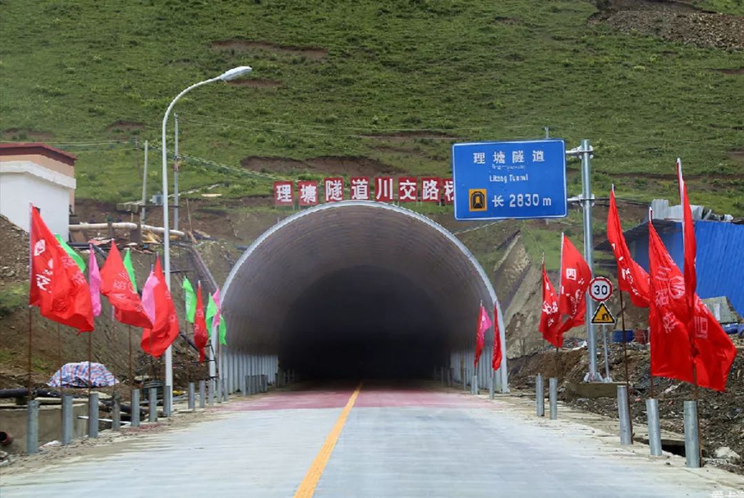
Photography / Sun Enjoyment
from Jianziwan Mountain
Trollakka Mountain is much less famous
(The altitude map of Pass 318 passed on the Internet also does not have its name)
More than 4,500 meters above sea level, Mount Toloraka
Just beside Litang, the highest city in the world
standing at the pass
You can see the whole county from afar
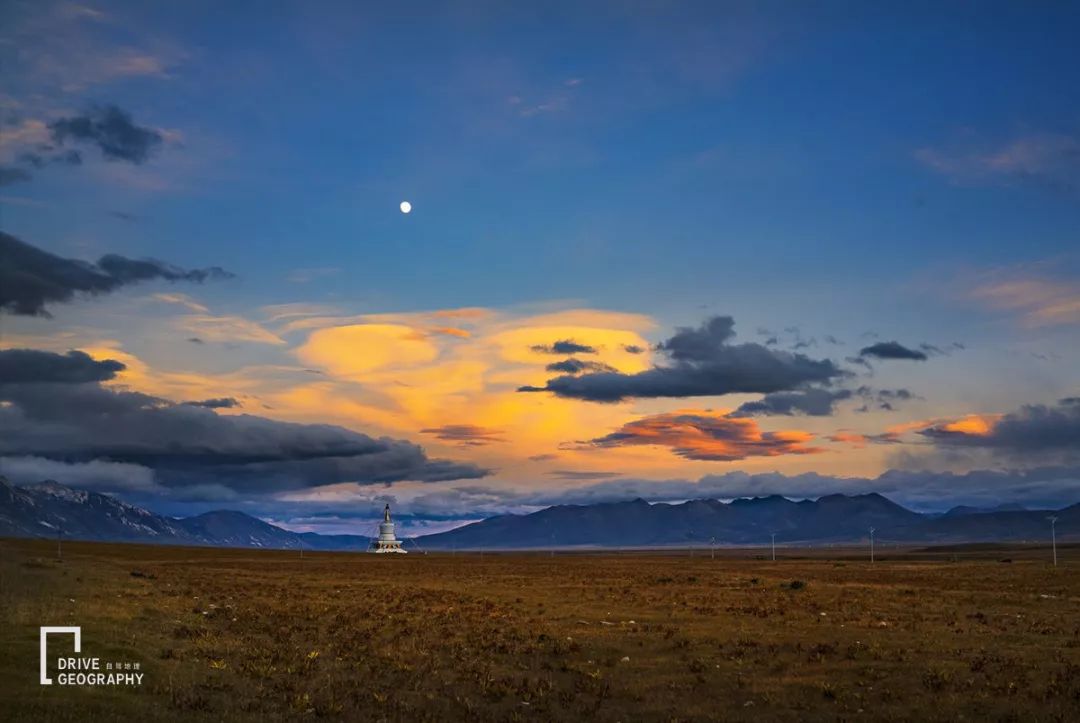
Maoya Prairie to the west of Litang County. Photography/Member faith
Mountain road in Tolo Raka
It is recognized as the “devil road section”
The average altitude is above 4000 meters
Even surpassed many snow mountain passes
Low temperature around the road
Hail, torrential rain and snowstorms are common
In the past, whether the driver can encounter it depends on the character
Litang Tunnel opened to traffic in 2015
Driving time reduced from 30 minutes to 3 minutes
Bicycles can also ride through the tunnel
ps. Unlike Gaoersi Mountain, the new lines of Scissors Bend Mountain and Toloraka Mountain are basically rebuilt on the basis of old roads.
The newly built roads and tunnels on the three mountains of Gaoersi Mountain, Jianziwan Mountain, and Tuoluo Laka Mountain belong to the national and provincial trunk line of National Highway 318. It will be abandoned… It should be noted that the old road is a backup road after all. Not only is the road condition poor, but it will not be cleared in time if there is a rolling rock landslide, and you may return without success.
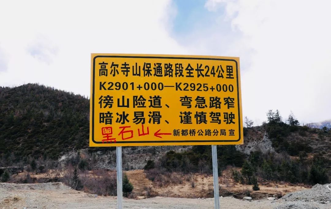
Gaoersi Mountain Old Road Baotong 24 kilometers, source/public account: Sichuan Tibet Travel Network

5. Tongmai Tunnel, built in 2012 and fully opened to traffic in 2016, “Five Tunnels and Two Bridges” replaced the original “Tongmai Natural Risk” and “Pailong Natural Risk” sections
As mentioned earlier, there are so many places in Sichuan
The danger of the old road at the high-altitude pass where the tunnel has been built
But the entire 318 Sichuan-Tibet South Line
What makes self-drivers talk about the “road” the most
But it is only 1,800 meters above sea level in Tibet.
Tongmai natural insurance
The former relies on care and experience
can also pass
But the latter relies on “resigning to fate”
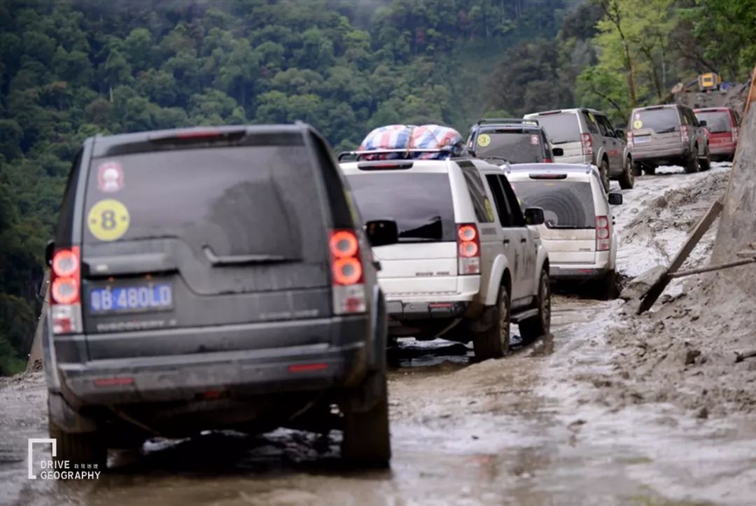
Pailong natural danger
It is a short 14 kilometers from Tongmai Bridge to Pailong Township
It often takes 2 hours or even longer to run
without it
Snow-capped mountains and rivers spread all over the line, and the mountain soil is loose
However, the precipitation is extremely abundant
Once encountering wind and rain or melting ice and snow
Highly prone to rockfall, mudslides and landslides
There are more than 300 geological disasters in one year
Among them, 102 sections of landslide group
Known as the “World Geological Disaster Museum” by the country
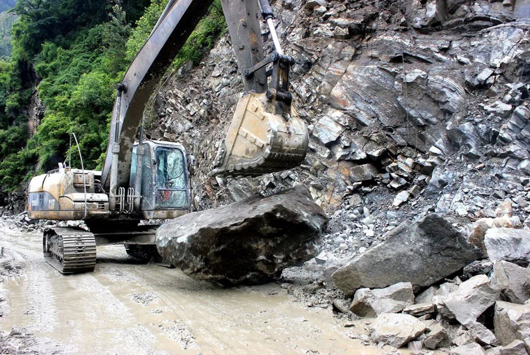
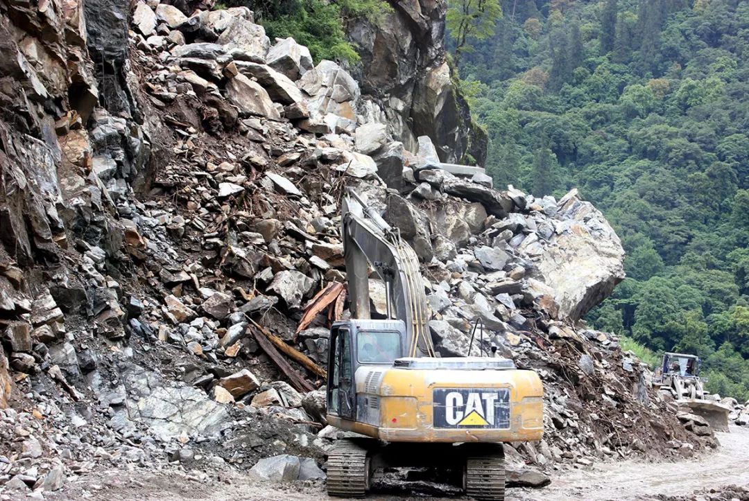
Source/Netizen 709213100
Coupled with narrow roads, there is very little room for wrong vehicles
muddy steep winding dirt road
Only one car is allowed
Only less than half a meter away from both sides
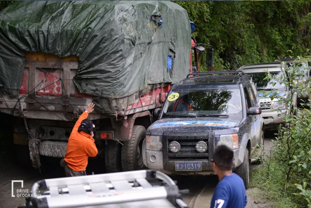
In 2014, Lao Bo commanded a difficult wrong car in Tongmai Tianxian
It’s normal to have long queues due to traffic jams here
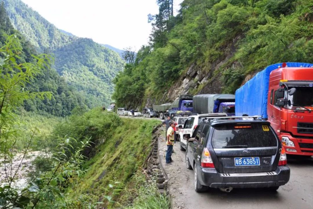
On one side is a cliff with rocks falling from time to time
One side is the 100-meter cliff
Car crashes happen from time to time
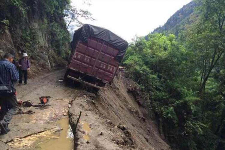
The most widely circulated picture on the Internet makes people feel a cold sweat
No matter how skilled the driver is, it depends on luck
Therefore, Tongmai and Pailong line
Known as “Death Road”
In 2012, the Sichuan-Tibet line reconstruction battle started
Tongmai Natural Insurance was included
The builders use the method of drawing salaries from the bottom of the pot
Erection of “five tunnels and two bridges” across mountains and rivers
Thoroughly solve the “stuck neck” problem of Tongmai Natural Insurance
(Five Tunnels: 102 Tunnel, Feishiya Tunnel, Xiaohuzui Tunnel, Palong No. 1 Tunnel, Palong No. 2 Tunnel; Two Bridges: Tongmaite Bridge, Shilonggou Super Large Bridge)
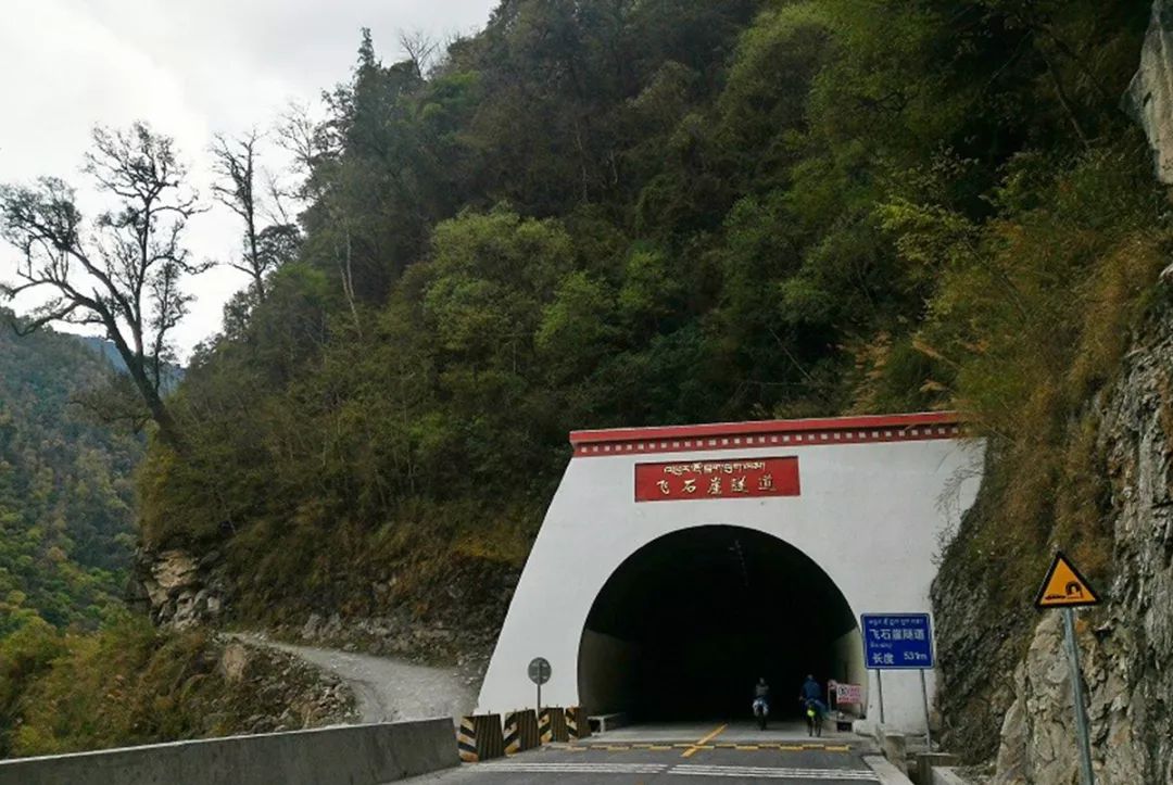
Feishiya Tunnel, the passage next to it is the old road that was once difficult and dangerous
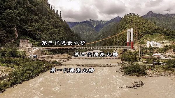
Source of background image: demo on the road
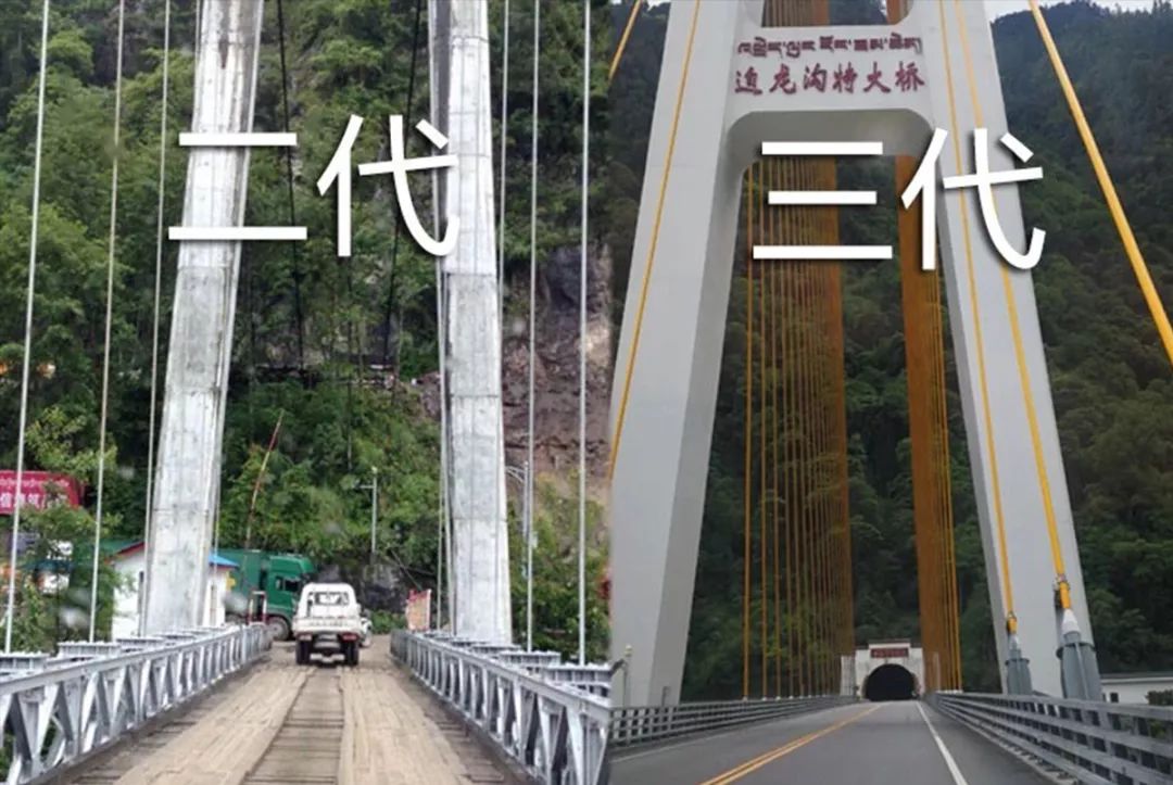
In 2016, the whole line was completed and opened to traffic
Two-hour journey reduced to 20 minutes
But it is different from the luck of the old roads such as Gaoersi Mountain
The old Tongmai natural danger route has been completely closed
The thrilling past
It’s all just legends…
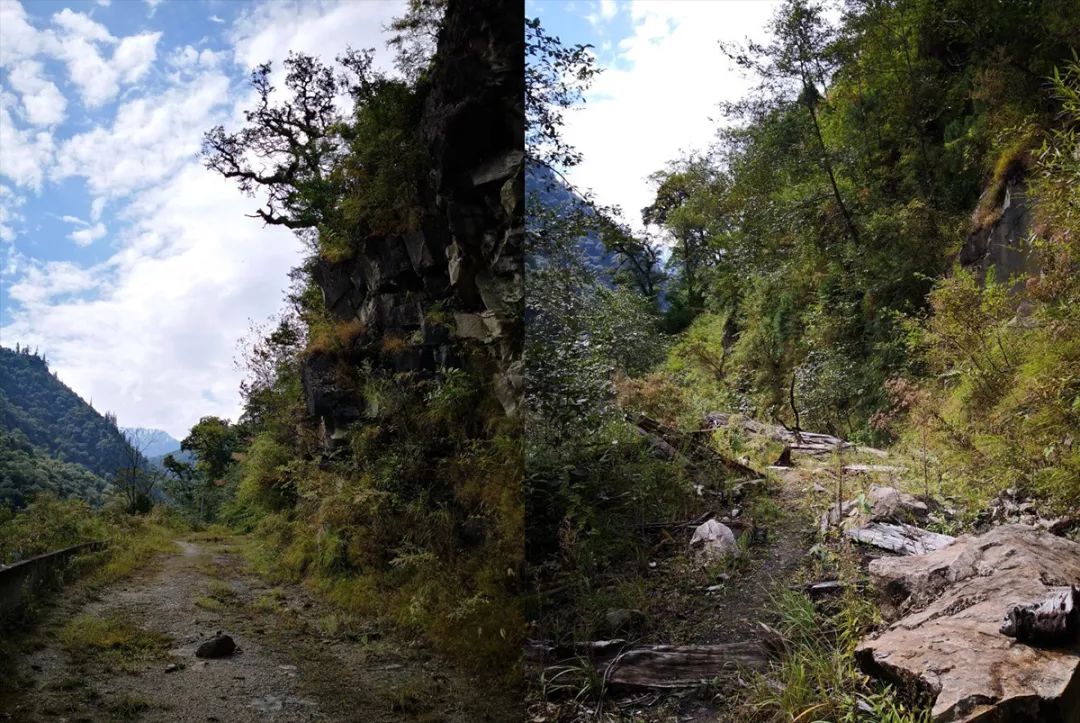
The old road on the left side of the Xiaohuzui Tunnel is now abandoned, overgrown with weeds, landslides, rocks and dead trees, and no one has cleared it. Source/Lao Ai

Under the unremitting efforts of infrastructure madmen
The upgraded 318 will get better and better
Although the scenery is slightly lost
but higher security
Many places along the line can also get better economic development
can only say:
Everything is the best arrangement
-Part of the picture comes from the Internet-
This account is Netease News · Netease account “each has its own attitude” signing account


