
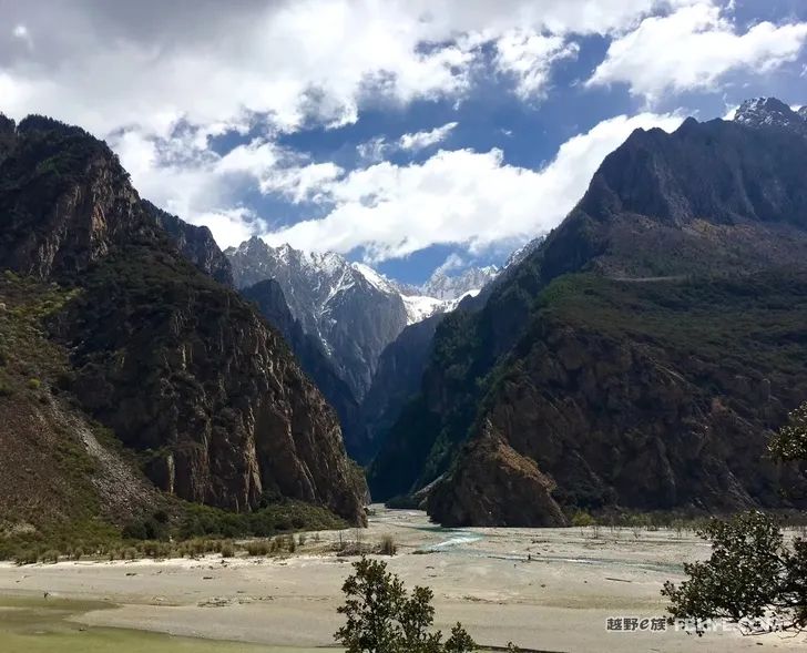
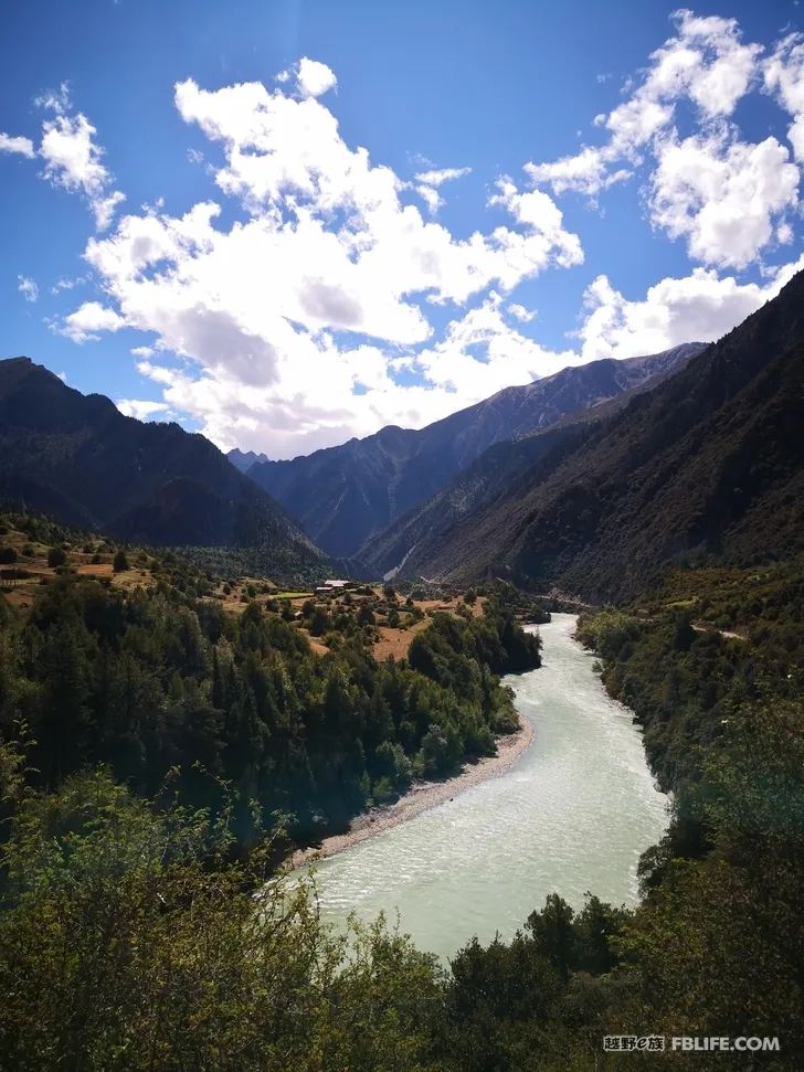
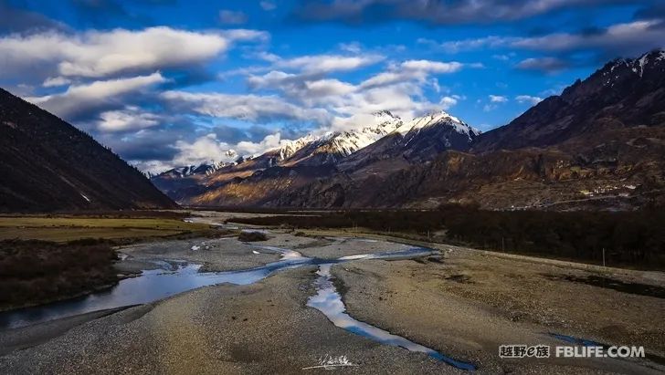
I will never forget that every time I fly to Tibet, when the famous Three Parallel Rivers area passes by, there will be a large white mountain rushing towards my face. At that moment, my heart will be extremely excited! And under the wing, the forest of snow-capped mountains is the beautiful southeast Tibet known for its high mountains, deep valleys and numerous icy peaks!
Outdoor Adventure Magazine once published an article in which the author made a self-definition of the core area of southeast Tibet, and explained it in his words:
1. To the west, it is roughly bounded by Yangxiu Township – Jiali County – Mila Mountain – Baidui Township;
2. In the north, the section of Yangxiu Township-Bianba County-Luolong County is the natural boundary of Provincial Highway 303;
3. Arrive in the east of Zayu County, Ranwu Town, and near Basu County;
4. From the south to Xiazayu Town – Medog County – Milin County – Lang County – Jiacha County
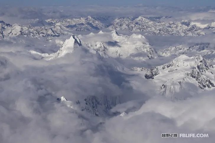
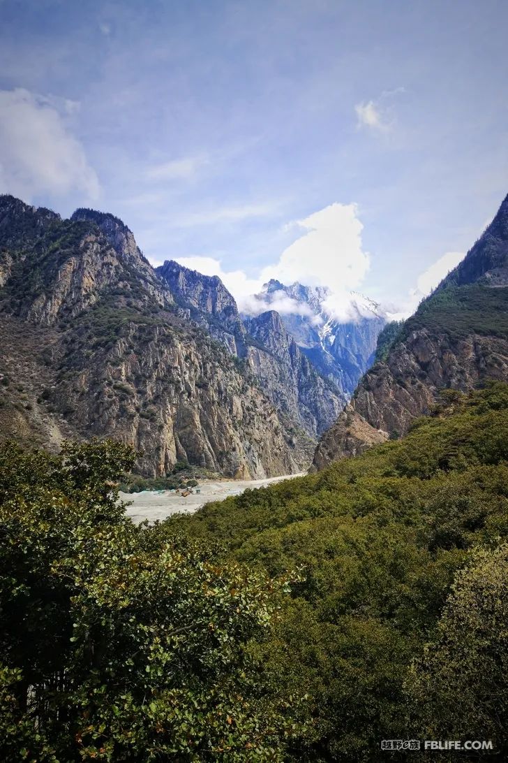
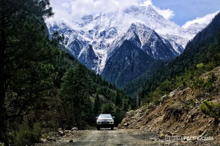
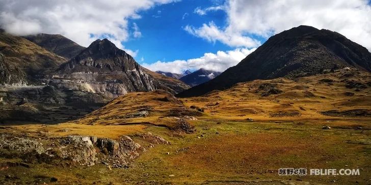
Although this is a very vague boundary division, to be precise, southeast Tibet is mainly composed of three major mountain ranges in terms of geographical structure, namely the Nyainqentanglha Mountains, the Himalayas and the Hengduan Mountains in the east. It took me a year to drive into the hinterland of Nyainqentanglha Mountains six times. There are snow-capped mountains, forests, glaciers, rugged roads, and cliffs. It is really a paradise for off-road enthusiasts! Just use this article as a record, recording every track I have traveled. Because I have lived in Nyingchi for a long time, I always take Nyingchi as the starting point every time, and enter through different paths, which also bring me different experiences.
Jiali, “Lari” in Tibetan, means holy mountain in Tibetan. The main mountains in the territory are Ayila Mountain, Lugongla Mountain, Jiela Mountain, Chula Mountain and Bengxila Mountain. Chula Mountain, which is nearly 6,000 meters away, is a natural barrier that is difficult to overcome on the Ancient Tea Horse Road. When the Eighteenth Army entered Tibet, it suffered heavy casualties and was called the Mountain of the Dead by the soldiers.
From Linzhi to Jiali, there are five routes, one of which is to detour through Mozhugongka, Menduo Township, and arrive at Jiali via Cuoduo Township. It is also part of the 349 National Highway currently planned. In 2016, I took this route back to Linzhi. , the road conditions are good throughout the journey, so I won’t say much for now.
The other four I have gone through are:
1. Nyingchi-Taizhao Ancient City-Niangpu Township-Tongguo Village-Zhaqingdui Ranch-Chula Pass-Menmengai Village-Janai Yucuo-Jiali County
2. Nyingchi-Taizhao Ancient City-Niangpu Township-Tongguo Village-Keruduo Village-Wulang Village-Wula Pass-Jiagi Village-S305-Jiali County
3. Linzhi-Jinda Town-Zhongrong Village-Cuoguo Village-Cuoduo Township-S305-Jiali County (Departing from Jinda Town, there is another ditch that can join this one in Cuuoguo Village and go to Cuodo Township )
4. Linzhi-Lulang-Yigong-Bagai-Zhongyu, complete the entire Nianqingdong itinerary, if you start with this line, then the end of the first day’s itinerary is Zhongyu, from here to Sapu or Bian Dam, friends who want to adapt to high altitude suggest this line as the first day’s itinerary, because the whole altitude is relatively low, which can help you adapt to changes in altitude better and faster
The four routes to Jiali each have their own characteristics, but no matter which one you take, you won’t regret taking it.
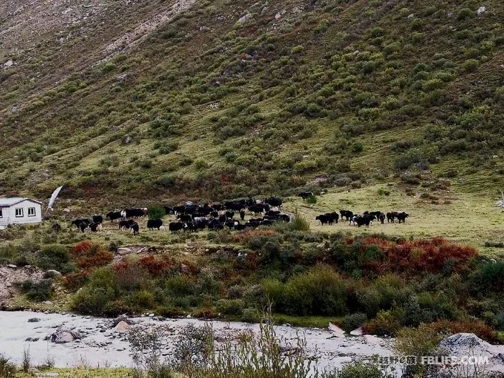
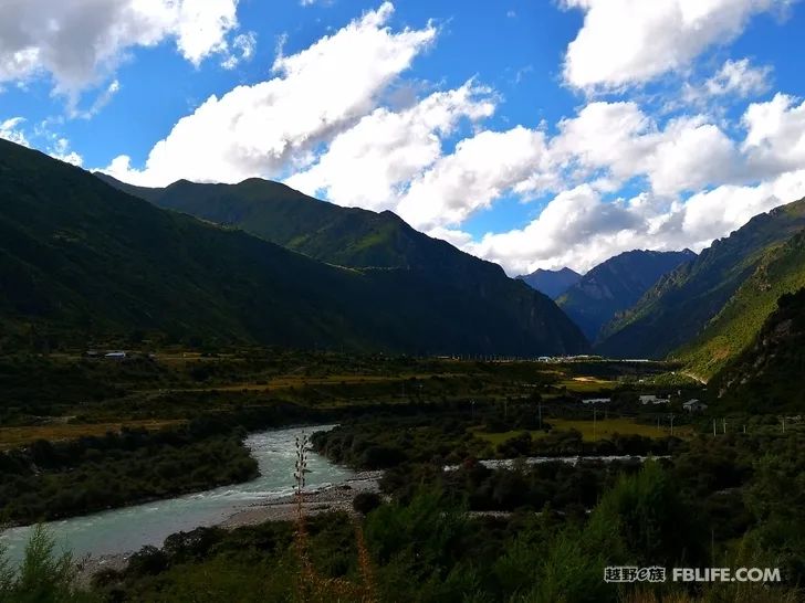
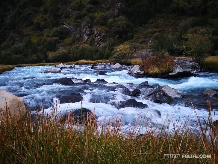
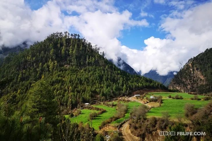
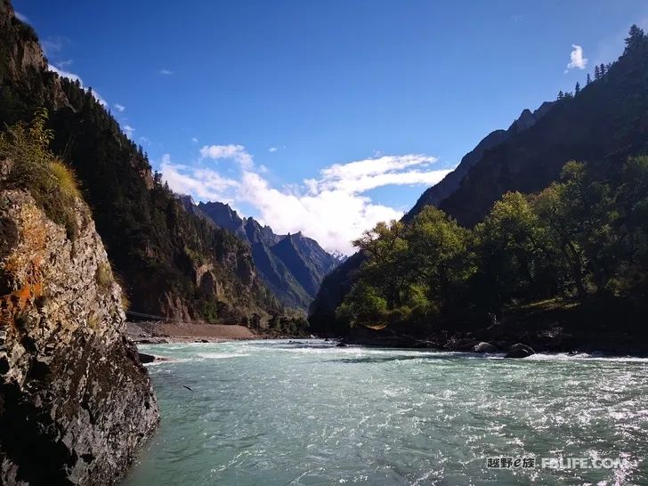
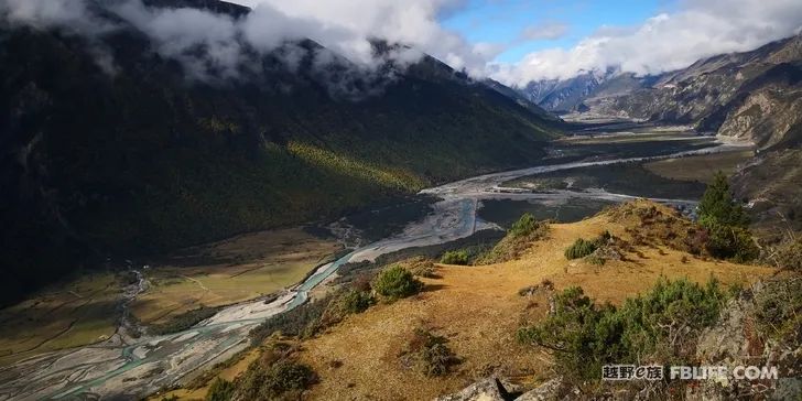
The Chula line, from Nyingchi to Niangpu Township, first reaches the ancient city of Taizhao through the expressway, and then the cement road reaches Niangpu Township. From here, it starts to enter the rural dirt road, which is basically relatively flat. Herds of yaks are unrestrained, and their freedom is enviable. After passing Zhaqingdui, I started to climb the mountain. Looking back on the way, I saw the perfect combination of snow mountains, grasslands and canyons, which was long and spectacular.
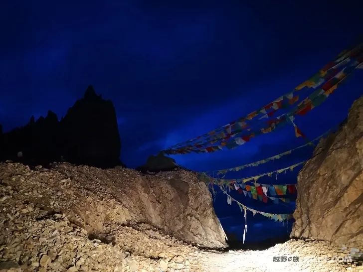
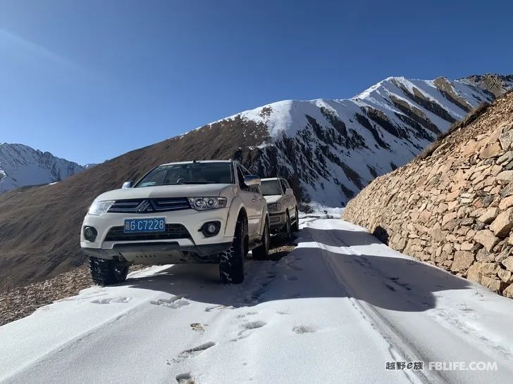
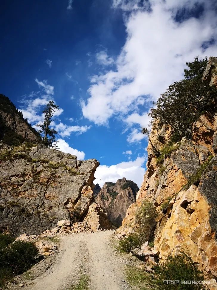
The 5,600-meter Chula Mountain Pass stands there like a heavenly gate. It has the aura of a man guarding the gate, and no one can open it. The mountain road near the pass is paved with small gravel, which is very soft and easy to trap cars. This There are still requirements for vehicle power, and four-wheel drive is the best. There is also a short section of the road down the mountain like this, and it is very easy to go further down. I passed the pass at 9 o’clock in the evening, and it was already very dark. It was a pity that I couldn’t take pictures for the rest of the itinerary, even passing through the beautiful Kana Yucuo.
This route was also the marching route of the 18th Army to liberate Tibet. They had suffered countless casualties and suffered heavy casualties here. This period of history cannot be forgotten, so this is also a red road worth remembering.
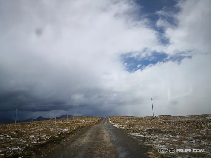
The Wula route was an alternative route that I had to choose when I entered Nianqingdong again at the end of November, due to the landslide of Bagai and the heavy snow at the Chula mountain pass. When Chula returned, turn right at Tongguo Village and pass through Wulang Village. It was completely dark, and the road behind was very bad. It felt like walking on the roadless grasslands of northern Tibet. We were only accompanied by the stars in the sky. The icy road made me tremble until ten o’clock in the evening, when the bright moon rose , I can see the surrounding environment a little bit, and my heart is much more settled. After leaving Wulang Village, the altitude behind is basically around 5000. At nearly twelve o’clock, we finally arrived at Jiali. Everyone is hungry. The plateau was cold, and my teammates suffered from severe altitude sickness. They stayed with me all night, barely resting, and were really exhausted. The altitude of Jiali County is 4,700 meters, and one-third of the road along the way is about 5,000 meters above sea level. Coupled with the fatigue on the road, it is easy to suffer from altitude sickness. Therefore, it is recommended that friends who have just arrived in Nyingchi, try not to choose this road, it is very hard!
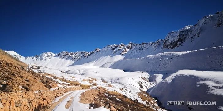
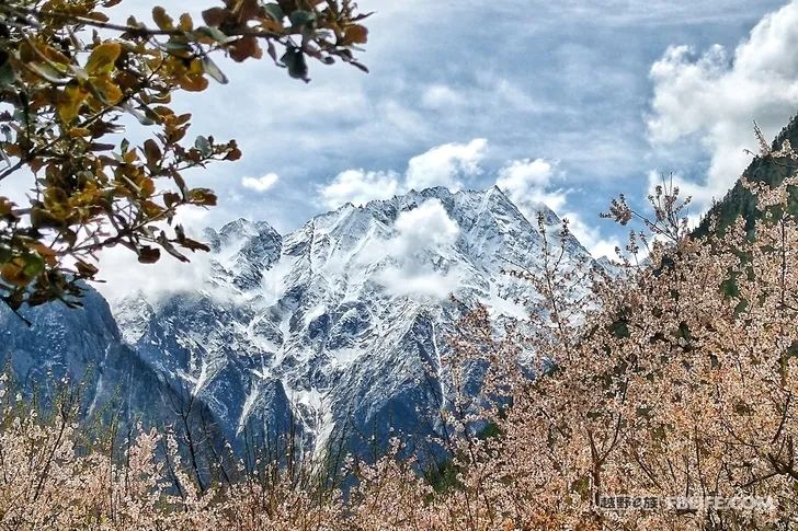
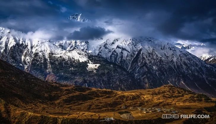
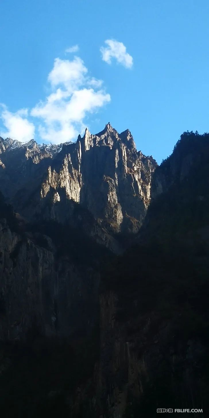
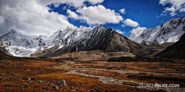
Chura Mountains in winter
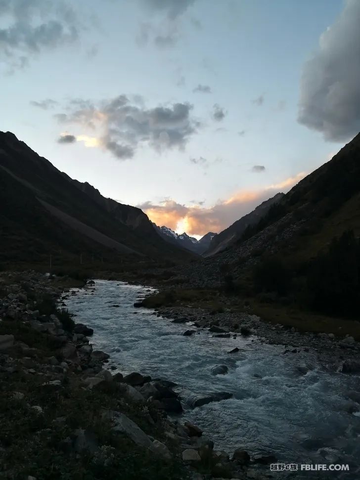
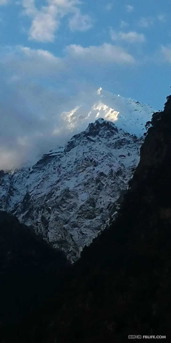
Chula Pass at night
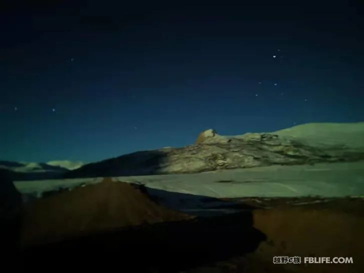
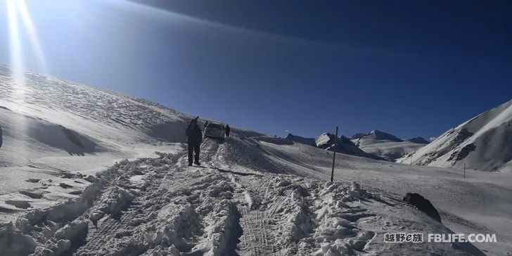
The only photo I took that night in Wulashan.
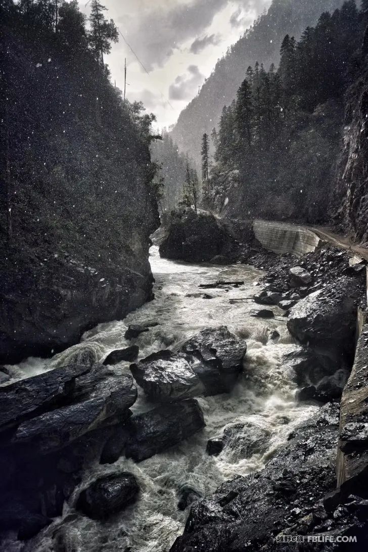
The Jinda line is really a bit far away. Fortunately, the entire expressway from Nyingchi to Jinda, and the road from Jinda to Zhongrong Village have all been paved with cement in 2019. In the valley, the songs are like a streamer full of gems, winding meandering down. Further up, you will enter the Riwengla area of more than 5,000 meters. This section of the road is almost bouncing on the rocks, which is very hard. Fortunately, such a road is not long, about 30 kilometers. After Cuola Township, there is a flat gravel road and the broad and atmospheric grassland in northern Tibet. This road changes scenery step by step, which is also a visual enjoyment.
The last thing I want to talk about is the route from Yigong Bagai to Zhongyu. This road has complex terrain and frequent mudslides and landslides all year round, but it is also rich in glaciers and charming snow peaks. It is hidden in dense forests and cannot be reached by ordinary people.
In May 2017, I walked with Guangzhou Shanren. From June 2018, due to mudslides, the road was closed until April 2019 when it was repaired. Then in September, the road was again closed due to road construction, and it has not yet been opened.
The beauty and hardships of this journey need you to experience it yourself.
I just briefly talked about the several roads leading from 318 to the narrow canyon in the hinterland of Nianqingdong. They are basically the itinerary on the first day of Linzhi’s departure, and there are different directions to choose on the second day.
1. Depart from Jiali County, pass through Lindi Township, Cuola Township, Medika Wetland, Niandian Township, and finally arrive at the county town, the whole journey is about 230 kilometers, cement road + shell pit + sand and gravel road
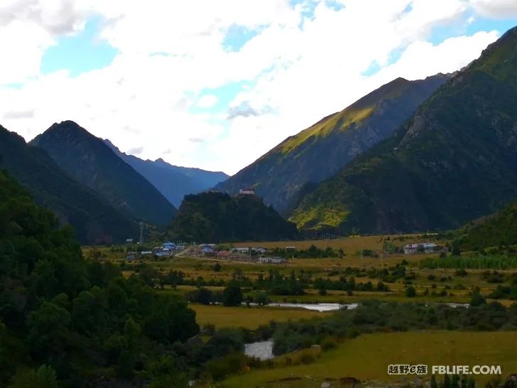
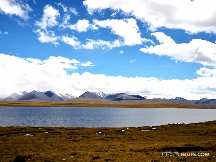
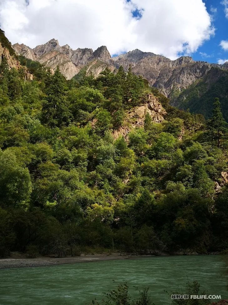
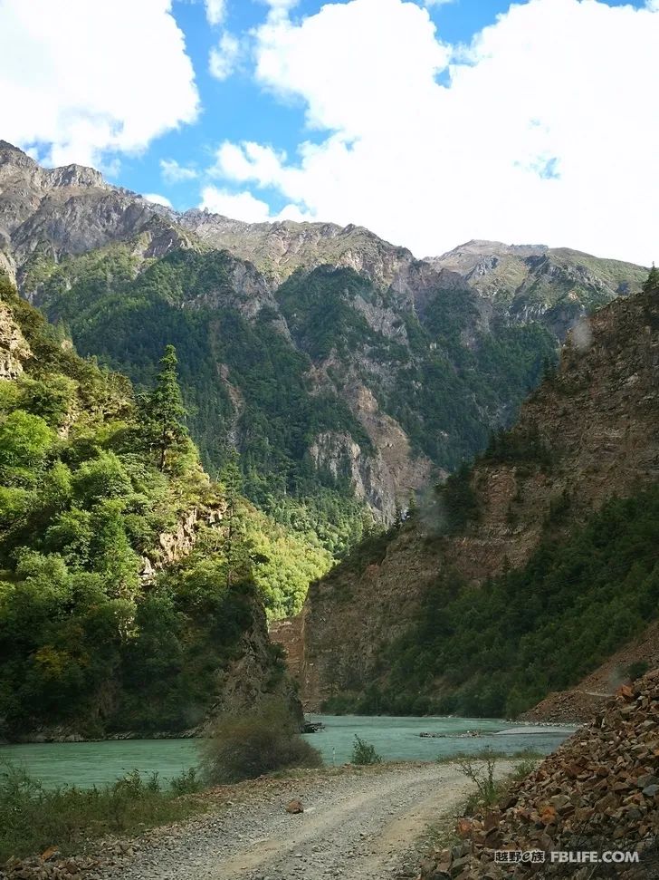
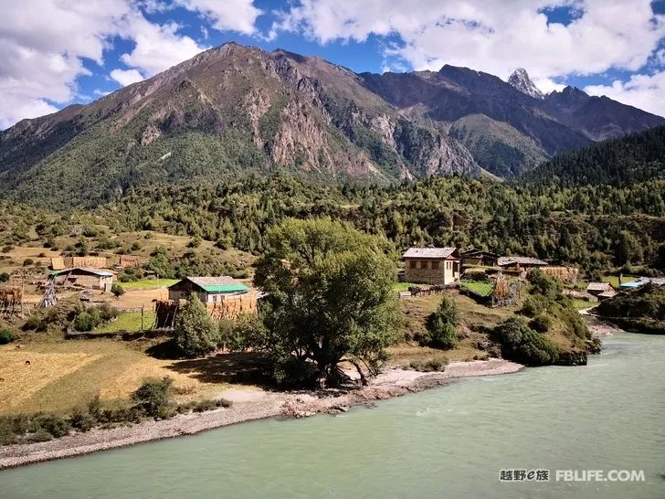
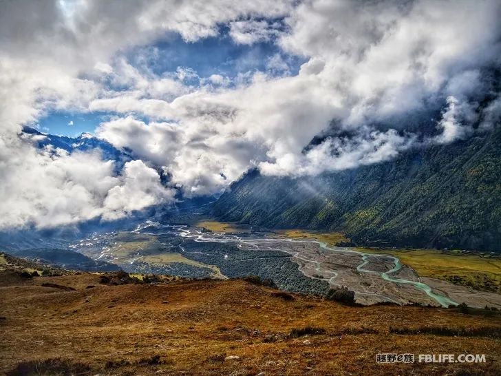
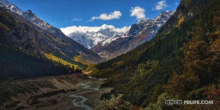
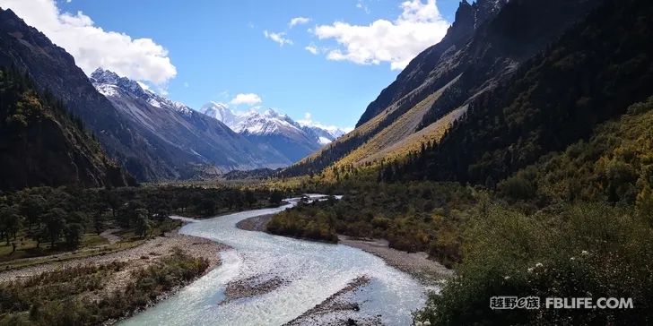
2. Depart from Jiali County, pass through Niwu Grand Canyon, and arrive at Zhongyu. The whole journey is part of the new National Highway 349, which is currently under construction. From the county seat of Jiali County to Niwu Township, the altitude drops steeply by one thousand meters and enters the alpine valley area. The trees get higher and higher, and the forest gets denser and denser. After crossing the 110-kilometer Niwu Grand Canyon, we arrived at Zhongyu Township. Because of road construction, the steep peaks on both sides of the canyon have become broken, which makes people feel upset. But when you walk out of the nunnery, your mood suddenly becomes brighter. The snow-capped mountains are coming one after another, the village is surrounded by snow-capped mountains, and the vegetation between the mountains and valleys is green.
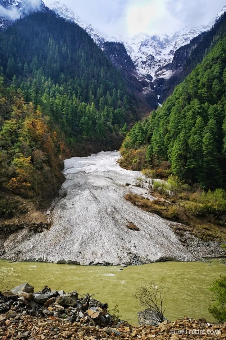
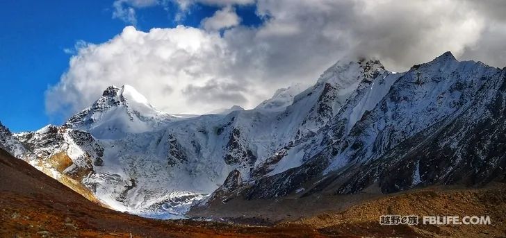
If all goes well, after arriving at Niwu, you can go up Nidu Zangbo to see the Yiga Glacier with a drop of 2,000 meters. I walked 5 times and didn’t find time to go there until the sixth time. Unfortunately, because of the weather, I still didn’t see the whole picture of it clearly. If you have time, you can stay in Yiga Village for one more day and climb up to the platform halfway up the mountain behind the village. You can overlook the Yiga Glacier on the opposite side of the river, and you can even see the 6,870-meter Nailang Peak.
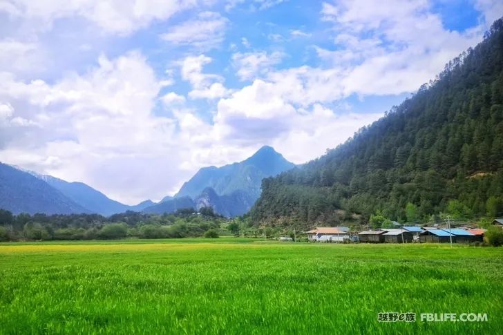
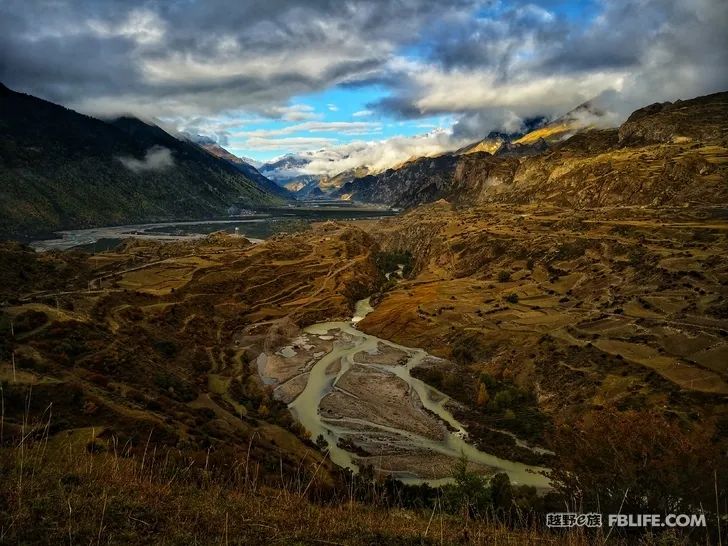
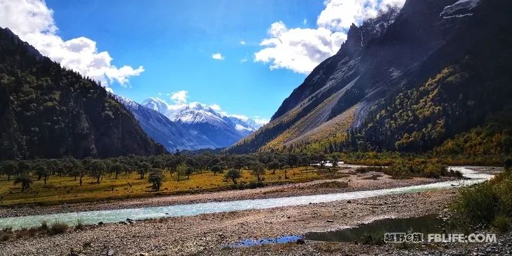
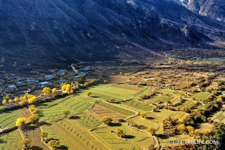
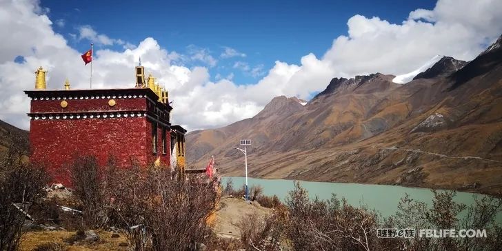
3. Friends who come from Bagai can leave for Jinling on the same day. Going to the canyon on Jinling Road, it is even worse than Niwu Grand Canyon. Looking from Zhongyu’s side to the entrance of the valley, the mountains are surrounded by mountains like a budding lotus standing on the side of the valley. Jinling Township has really become my great love. The thousand-year-old seabuckthorn that grows naturally along the banks of the Xiaqu River stretches for more than 10 kilometers.
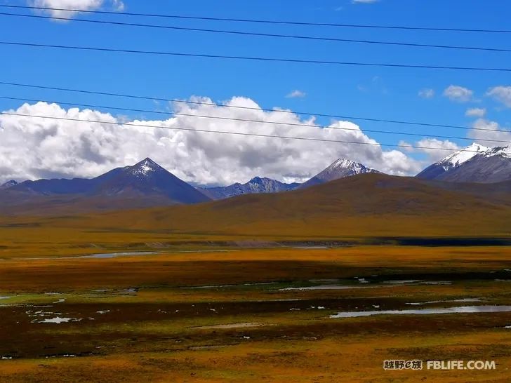
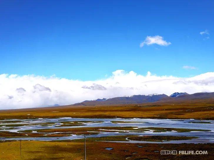
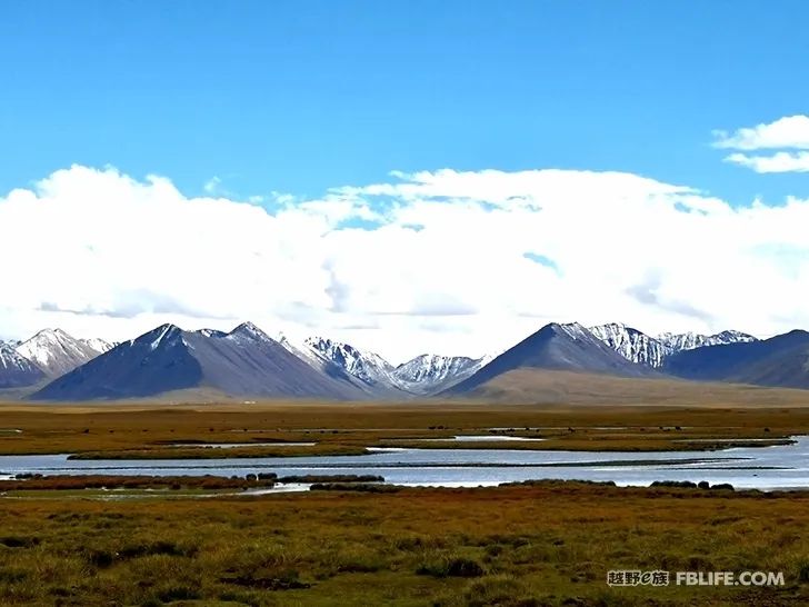
Medica Wetland
Jiali to Zhongyu, and then to Jinling are all part of the new National Highway 349. The roadbed from Jinling to Zhongyu is basically completed, and it is relatively flat; the roadbed from Zhongyu to Jiali is still under construction and will be released in time , If you want to take that path in 2020, you still have to prepare for hardship.
Zhongyu to Jinling Township
Jinling, I can give it only two words: sublime.
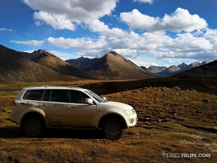
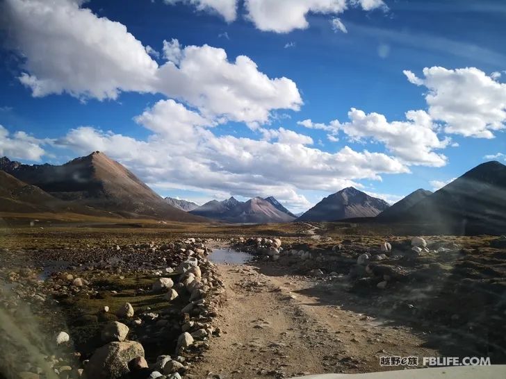
Post two photos taken by my teammates
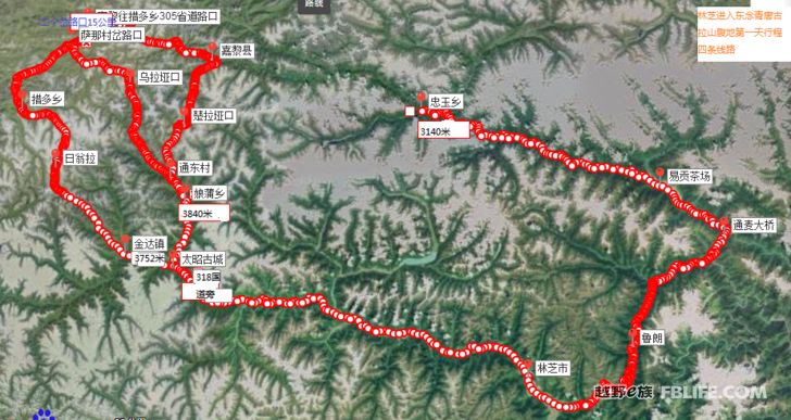
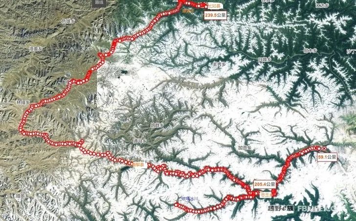
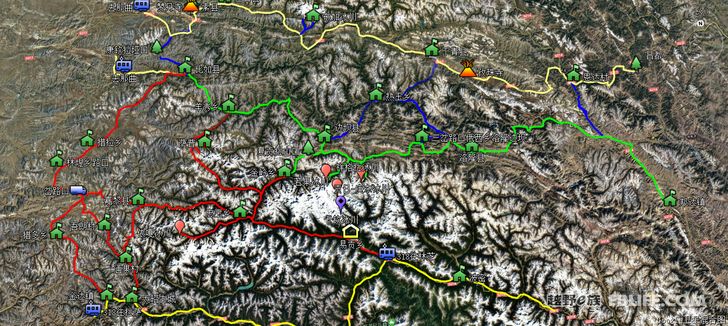
Reworked a map, it might look clearer.
In the map, the upper yellow line is National Highway 317, the horizontal green line in the middle is National Highway 303, the vertical blue line is several lines from 317 to 303, and the red line is several lines in Jiali area, and the bottom yellow line is horizontal It is National Highway 318.
The next step I want to try is whether the road from Bomi to Luolong, and from Shading Township or Shuodu Township to Baqing can be passed through.
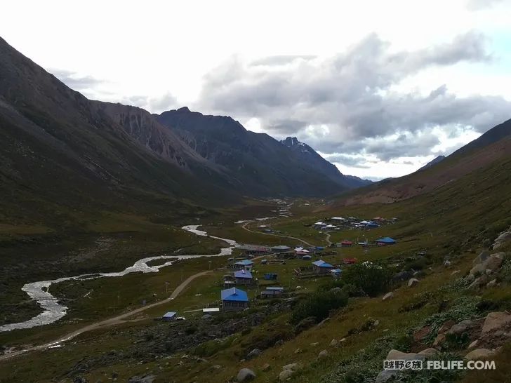
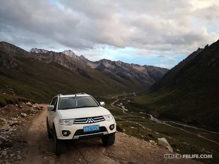
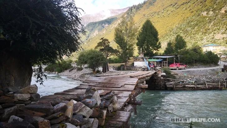
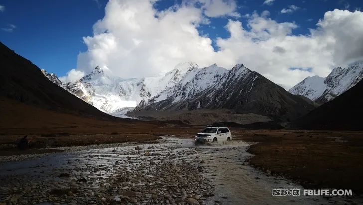
From Zhongyu Township to Jiagong Township, the first half is along the road to Jinling, and turn left at the fork near Yuba Village. In 2019, cement has been completed from this fork to Jiagong, and the cement road extends to Guoqing Village inside. As a result, when the weather is good, it is possible to reach Yepujianla from Zhongyu to Sapu, which climbs 5150 meters a day. Maybe it’s because I walked in November and the mountain road was full of snow, so I didn’t feel the muddyness that my friend said before. After climbing over the mountain, you will soon reach the 4,600-meter Bundang Longye. From here, you will walk on the asphalt road until you reach the Sangda Temple. The road from Sangda Monastery to Sapu has not been repaired, and it is still quite bumpy, but there is nothing wrong with ordinary SUVs driving slowly, so don’t worry.
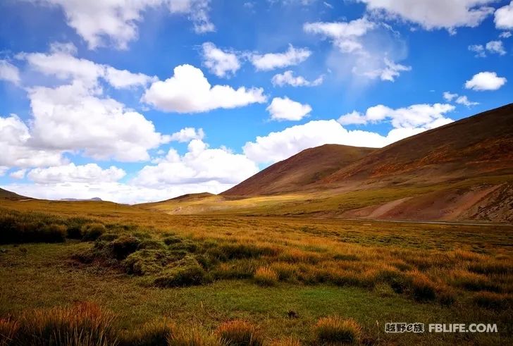
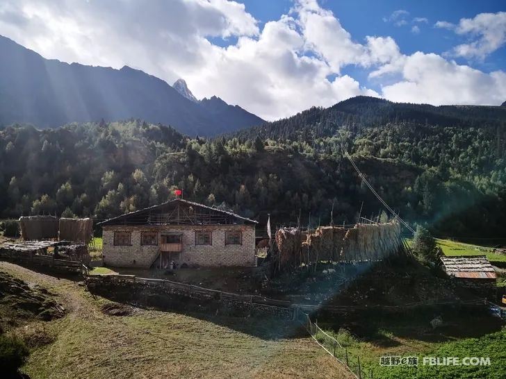
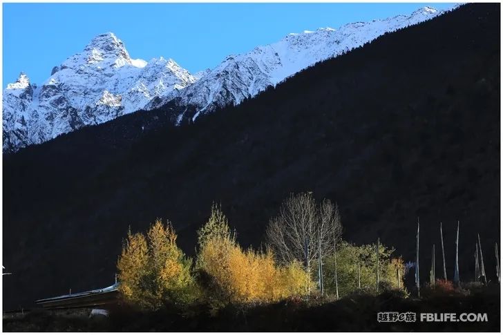
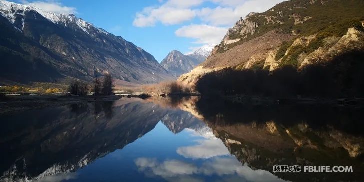
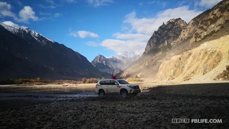
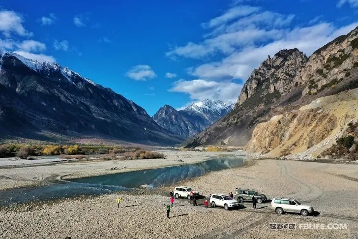
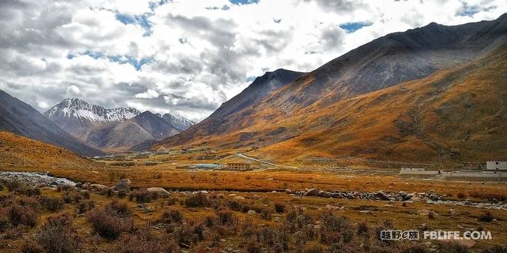
Send a few photos of us walking this road in November, Zhongyu in November is still a golden autumn scene.
The epidemic in 2020 came suddenly. It has been March and I still can’t return to Tibet. Without any income, I can only type at home. season’s arrival.
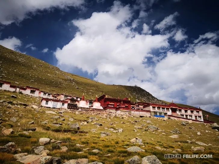
Sapu Mountain, the hottest tourist destination in Tibet in the past two years, too much text introduction, not much to say, just post a few photos and introduce the location of the photo.
Come over from Jiagong, there is a fork in Bundang Longye, turn right to reach another ditch on the back of Sapp, and the end is the west side of the main peak of Sap.
The following photos were taken when I climbed to the mountain on the right side of the Sapu Temple in Sapu.
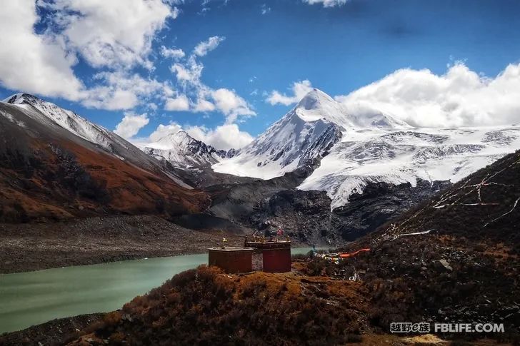
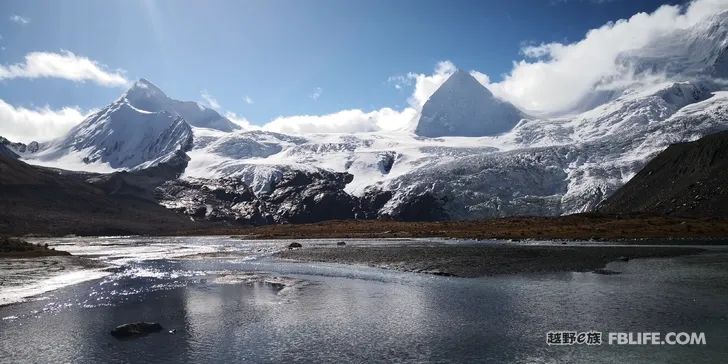
Continuing to climb up from Sapu Temple, you can reach the foot of Sepugang Ribeiwei Peak at an altitude of 6,650 meters. There is a small ice lake here. The lake is milky white. It is not very beautiful, but the shape of the pyramid-shaped mountain is quite beautiful. .
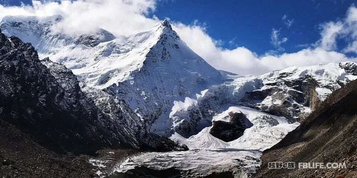
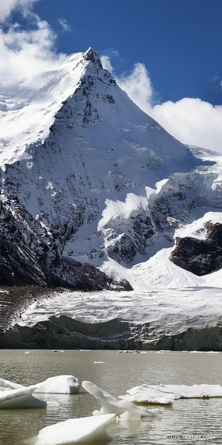
Gosham taktso at an altitude of 6296 meters and Xuemo peak at an altitude of 6236 meters.
[The content comes from the off-road e family community]
Author: Speechless Tibet
Link: http://bbs.ucar.run/thread_14751626_1_1.html