【Foreign articles】
1. US Route 66
Route: Chicago Chicago—St.Louis ST.Louis—Oklahoma City Oklahoma—Albuquerque Albuquerque—Flagstaff Flagstaff—Los Angeles
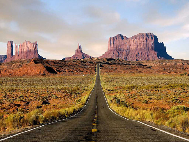
The legendary Route 66 was once the most important east-west route in the United States. I believe that road movie lovers will still remember the road in the camera as if it stretches to the end of the world. It starts in Chicago, Illinois, passes through Missouri, Kansas, Oklahoma, Texas, Arizona, and arrives in Los Angeles, California, spanning 8 states and 3 time zones. 3900 kilometers. Today, although this “American Mother Road” has gradually declined, it is still one of the must-go roads for self-driving tour enthusiasts.
2. Great Ocean Road, Great Ocean Road, Australia
Route: Torquay Town – Geelong Geelong – Torquay Torquay – Apollo Bay – Apollo Bay – Port Campbell – Warnambool
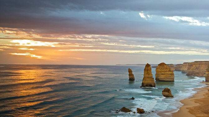
This beautiful coastal road, one of the few in the world, winds along the west coast of Victoria for 276 kilometers and is the most famous self-driving tour route in Australia. It stands on the reef, and the end is the essence of the whole road – The Twelve Apostles (The Twelve Apostles) in (Port Campbell National Park) in Port Campbell National Park. Driving all the way through the coastline with infinite scenery and experiencing the uncanny craftsmanship of nature must be the biggest gain for many travelers in Australia.
3. California Route 1
Route: San Francisco——San Jose——Big Sur——Santa Barbara——Los Angeles
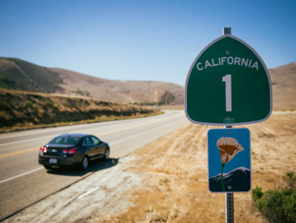
The California Highway 1 built along the mountains and the coast is known as the most dreamy highway in the world. You can enjoy many unique scenery here, the most famous of which are Hearst Castle and 17 Mile Bay. It starts from Leggett in San Francisco in the north and ends in Dana Point in Los Angeles in the south, with a total length of more than 1,000 kilometers. Self-driving on Highway 1 needs to slow down, and find some beautiful towns like oil paintings to stay for a few nights on the way, such as Santa Barbara, Carmel Town, etc., and quietly feel the romantic atmosphere here.
4. Icefields Parkway, Icefields Avenue, Canada
Route: Banff National Park Banff National Park – Lake Louise Lake Louise – Columbia Icefield Columbia Icefield – Jasper National Park Jasper National Park
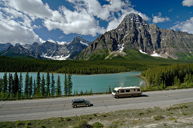
The Icefields Avenue is regarded as one of the most beautiful roads in North America. It stretches 229 kilometers from Banff National Park to Jasper National Park. Along the way, you can see the changing scenery of waterfalls, emerald lakes, grasslands and snow-capped peaks. picture scroll. Look up at many peaks at an altitude of 3300 meters, enjoy more than 100 glaciers, sub-alpine meadows, pure and crystal waterfalls, icy blue lakes and a lot of wild life. This spectacular drive offers year-round charm.
5. Tango Ruta 40, Route 40, Argentina
Route: Patagonia region in the south (santa cruz, Chubut, Río Negro, Neuquén provinces) – Cuyo region in the middle (Mendoza, San Juan, La Rioja provinces) – northern region in the north (Catamarca, Tucumán, Salta , Jujuy provinces)
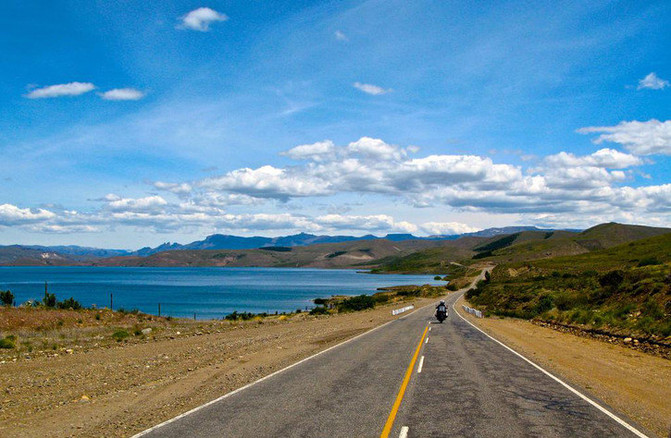
Argentina’s Highway 40 is the most beautiful landscape avenue in South America, with a total length of more than 4,900 kilometers, so it is also one of the longest highways in the world. It connects 20 national parks, 18 major rivers, passes through the Andes Mountains 27 times, and runs through the entire territory of Argentina from north to south. At the age of 23, Che Guevara rode his Norton 500 on Route 40, started his journey and wrote “Motorcycle Diary”. Like National Highway 318 in China and Highway 66 in the United States, Highway 40 in Argentina is also a leader among self-driving landscape roads, a dream road for self-driving explorers all over the world.
6. South Island Highway, a small ring road in South Island, New Zealand
Route: Christchurch – Greymouth Greymouth – Franz Josef Glacier Franz Josef – Queenstown Queenstown – Lake Tekapo – Christchurch
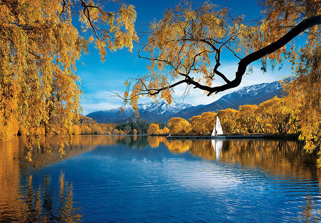
New Zealand’s South Island is known as “the only remaining pure land in the world except for the North and South Poles”. It has natural beauty such as snow-capped mountains near the sea, quiet fjords, pure glaciers and vast plains. Among them, the most famous one is Queenstown, where the movie “Lord of the Rings” was filmed, and Christchurch, a tourist attraction and garden city. There are many self-driving routes in the South Island to choose from, but the route with the most beautiful scenery and the most essence is the small ring road in the South Island recommended above. You will know the meaning of “beautiful” after experiencing it yourself.
7. Iceland Highway 1
Route: Reykjavik Reykjavík—Geysir Geyser—Seljalandsfoss—Vik Town—Vatnajokullglacier—Hofn—Gulf Port Seydisfjordur—Detti Waterfall Deffifoss— — VITI Crater Lake — Barnafoss Waterfalls — Reykjavik Reykjavík
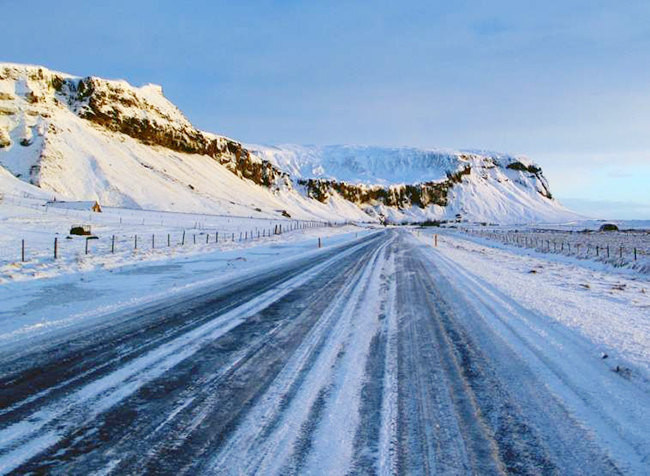
As one of the landmark buildings in Iceland, Iceland Highway 1 is known as “the road of ice and fire through heaven”, with a total length of about 1336 kilometers. This title comes from the fact that this road will pass through multiple bays, subarctic deserts and the Atlantic coast along the way. Self-drivers will experience the double feeling of ice and fire. The entire road forms a big circle that surrounds the whole of Iceland. Along the way, overlooking the Atlantic Ocean on the edge of the cliff, walking through fjords where dolphins are infested, walking through frozen soil, forests and volcanoes, you can really feel the ultimate feeling of this Viking country.
8. Hana Highway
Route: Kahului, Kahului – Hana
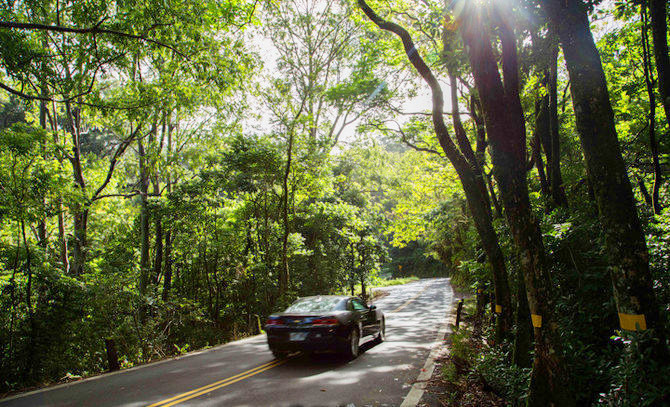
The Hana Highway runs through the northern coast of Maui, Hawaii, USA, with a total length of 109 kilometers and is considered one of the most beautiful roads in the world. It starts in the town of Kahului and winds around 600 corners to the east in about 3 hours to Hana. The road surface is narrow and winding, and at every bend, you can see magnificent sea views, black-sand beaches, rushing waterfalls, and deciduous trees that stretch for miles. Both sides of the road are covered by dense tropical rainforest, which forms a natural green arch for the rolling road, and the Garden of Eden in the dream is right in front of you.
【Domestic articles】
1. Sichuan-Tibet Highway
Route: Chengdu – Ya’an – Kangding – Yajiang – Litang – Batang – Mangkang – Zuogong – Basu – Ranwu – Bomi – Nyingchi – Mozhugongka – Lhasa
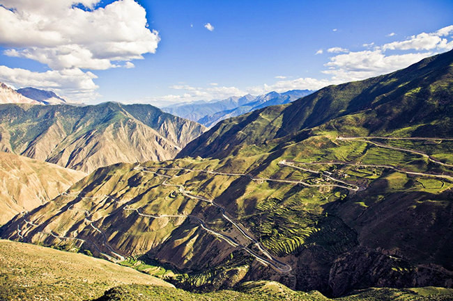
In recent years, self-driving, cycling, and hitchhiking on the Sichuan-Tibet line have become a phenomenon in China. Although it may not be as mysterious as the legendary “Pilgrimage Road” in the minds of many people, its charm is still irresistible. This veritable Chinese landscape avenue starts from Chengdu in the east and ends in Lhasa in the west, with a total length of about 2,200 kilometers. It is the most scenic section of National Highway 318 (Shanghai-Zhangmu). All the way to climb the mountains, through the rushing river, flower sea grassland, glacier and snow mountain, blue lake, mysterious Tibetan dwelling… For the self-driving people, the rugged and steep road adds infinite excitement to the conquest journey.
2. National Highway 214
Route: Xining – Huangyuan – Huashi Gorge – Bayan Har Pass – Yushu – Batang – Nangqian – Qamdo – Bangda – Mangkang – Deqin – Lijiang – – Dali – Lincang – Lancang – Jinghong
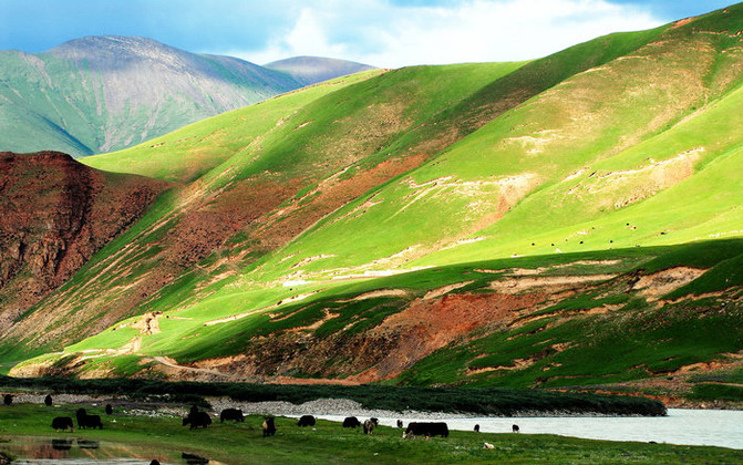
National Highway 214 is currently the humanistic road with the richest humanistic and historical resources in China. It extends from the tip of Qilian Mountain in the west of Xining to the hinterland of the Qinghai-Tibet Plateau and reaches the colorful Yunnan-Guizhou Plateau. The altitude difference along the route reaches several thousand meters, and the amazing natural scenery, rich historical culture, extensive religious culture, and diverse ethnic customs are sprinkled throughout the journey, which is the real road of Chinese customs. Step on the accelerator, and you embark on this journey across the sources of the Yellow River, Yangtze River, Jinsha River, Lancang River and other rivers.
3. Qinghai-Tibet Highway 109
Route: Lhasa – Nagqu – Amdo – Tuotuo River – Golmud – Chaka – Xining
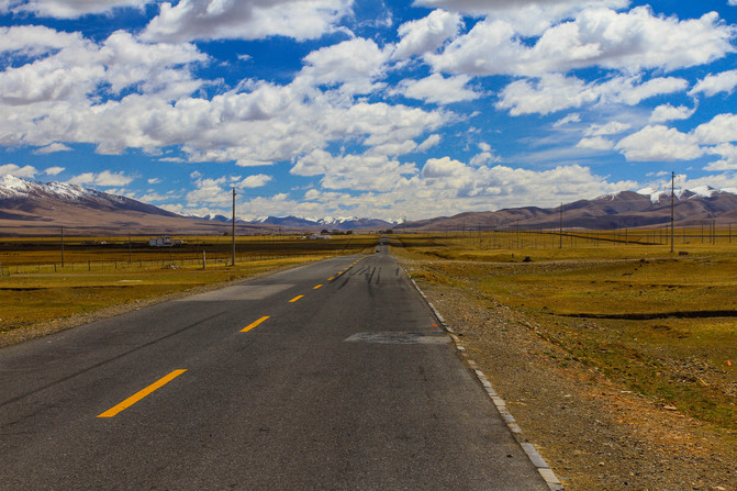
The Qinghai-Tibet Highway is one of the highest highways in the world, and is currently the best one among several highways entering Tibet. It is 2,800 kilometers long and has an average altitude of over 4,000 meters. Starting from Xining, we traveled all the way through mountains and ridges, passing Hoh Xil and Tanggula Mountains, experiencing the desolate no-man’s land, feeling the vicissitudes of nature, and finally arrived at the holy city of Lhasa.
4. Xinjiang-Tibet Highway
Route: Lhasa – Shigatse – Lazi – Saga – Zhongba – Mapang Yumco – Shiquan River – Kashgar
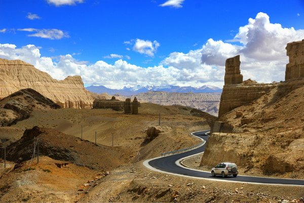
From Tibet to Xinjiang, there are N roads to choose from. Most people will choose to take a section of the Qinghai-Tibet Highway to go to northern Xinjiang, because this road is recognized as the most difficult, the most perseverance, the worst environment, and the most sparsely populated extreme road. Countless experienced self-driving, cycling Xingda people were tortured to death on this road. However, along this 1,455-kilometer “Road of Death”, you can explore the ruins of the ancient Guge Kingdom, the holy mountain Kailash, the holy lake Manasarovar, and the birthplace of the Yellow Sect – the Sakya Monastery. Seeing groups of Tibetan wild donkeys, yellow sheep and other wild animals, the scene is very spectacular, so it is also a paradise for explorers. If you have enough courage and technology, then set foot on Xinzang Road to see it!
5. The northeast border of Inner Mongolia
Route: Manzhouli – Heishantou Port – Five Cards – Seven Cards – Nine Cards – Shiwei – Enhe – Erguna – Hailar – Manzhouli
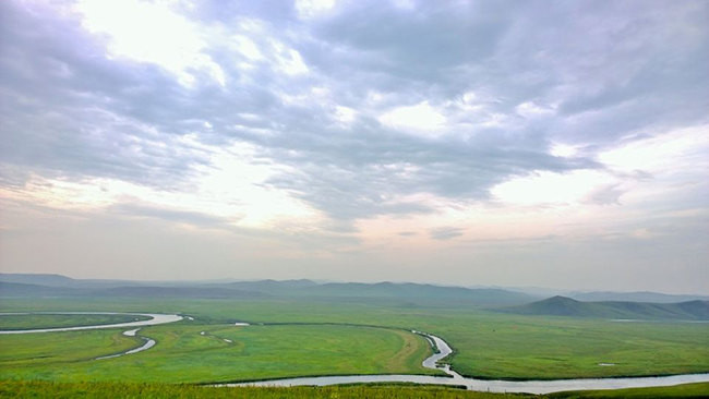
When it comes to Inner Mongolia, the first image most people think of is the blue sky, white clouds, and herds of cattle and sheep. In fact, there is a beautiful self-driving route near the Sino-Russian border in the northeast of Inner Mongolia. This route departs from Manzhouli and goes northward to Shiwei Port. Along the way, you can see the magnificent Ergun River and stay in the unique Russian ethnic township (Enhe)… The short-distance small ring route (the route above) can be completed in 2 days If you have enough time, you can continue north along the Shiwei Port to Mohe County, Heilongjiang Province, and experience the fun of the Arctic Village. Then go south to Hailaer, continue southward to the famous Aershan Forest Park, and then return to Manzhouli via the New Balhu Left Banner and Right Banner, and complete the Great Ring Road that sweeps all the boundary rivers, wetland parks, forest parks, and grasslands.
Tips: Great Ring Road Reference: Manzhouli – Heishantou – Five Cards – Seven Cards – Nine Cards – Shiwei – Linjiang – Mordaoga – Mohe – Genhe – Erguna ——Hairar——Honghuaerji——Aershan——New Balhu Left Banner——Manzhouli
6. The Silk Road (Chinese section)
Route: Xi’an – Baoji – Tianshui – Lanzhou – Wuwei – Zhangye – Jiayuguan – Guazhou – Dunhuang – Liuyuan – Hami – Turpan – Urumqi – Aksu – Kashgar
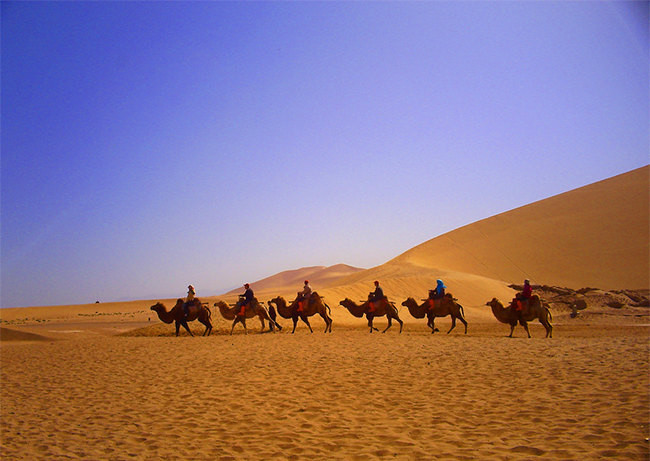
The once prosperous Silk Road was opened by Zhang Qian as an envoy to the Western Regions in the Western Han Dynasty. It started from Chang’an (now Xi’an), passed through Gansu and Xinjiang, went to Central Asia and West Asia, and connected the land passages of Mediterranean countries. Its eastern and middle sections are in China, with a length of about 4,000 kilometers from east to west. Along the route, you can see the oil painting-like scenery of the northwest, and experience a desolate and passionate desert trip. It is a classic route for self-driving across Northwest China.
【Transnational Chapter】
1. Karakoram Highway
Route: Kashgar (Xinjiang, China)——Taxian Hongqilap Port—Sost (Pakistan)——Pasu——Krimabad (Hunza Valley)——Gilgit——Skardu——Islamabad (Islamabad)
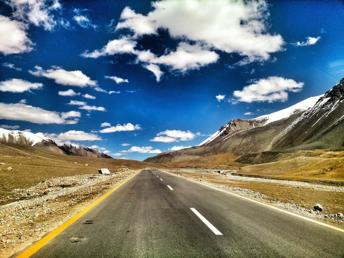
The Karakoram Highway (KKH for short) is the highest international highway in the world and a part of the once world-famous “Silk Road”. It starts from the city of Kashgar in Xinjiang, China in the north, crosses the Karakoram Mountains, the Hindu Kush Mountains, the Pamirs, the western end of the Himalayas, passes through the Khunjerab Pass at the China-Pakistan border port, and ends in Takot, a city in northern Pakistan in the south. 1224 kilometers. The mountain scenery along this road is the best in the world, and its thrilling spectacle once cost 1,000 road workers to sacrifice. Choosing to travel on the Karakoram Highway is not only an understanding of the power of nature, but also a spiritual challenge.
2. The southern section of National Highway 318 of China-Nepal Highway
Route: Lhasa – Shigatse – Lazi – Tingri – Zhangmu (China-Nepal Port) – Kathmandu (Nepal)
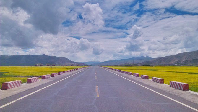
The China-Nepal Highway is currently the only international direct highway in Tibet, with a total length of 943 kilometers and 829 kilometers in Tibet (the southern section of National Highway 318). It starts from Lhasa and passes through Shigatse and Zhangmu Port to Kathmandu, the capital of Nepal. Since the road can go from Tingri to the Everest base camp, there are countless motorcades driving on this road every year. This trip can uncover the mystery of Houzang and enter one of the happiest countries in the world – Nepal.
3. Kunman Highway
Route: Kunming (Yunnan, China)——Yuxi——Pu’er——Xishuangbanna——Mohan (Xishuangbanna)——Boten (Laos)——Louang Namtha——Phngsali——Huei Xai— — Chiang Khong (Thailand) — Chiang Rai — Lampang — Chiang Mai — Sukhothai — Bangkok
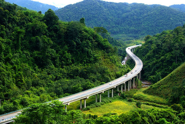
The 1,800-kilometer Kunming Highway spans three countries and consists of the Chinese section (827 kilometers), the Laos section (247 kilometers) and the Thailand section (813 kilometers). It begins in Kunming, Yunnan Province, enters Laos via Yuxi, Pu’er, and Xishuangbanna, then enters Chiang Khong, Thailand from Huixay, and finally arrives in the capital Bangkok. Rich ethnic customs, traveling through the tropical rainforest and tempting food are the biggest highlights of this journey.
The content comes from Ctrip.com – Self-Driving Maniac.


