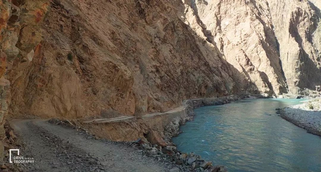
Picture by VIP member Xu Xiake
it exists for thousands of years
There is very little information available
it’s full of legends
Xuanzang once walked here on his journey to the west to learn Buddhist scriptures
it’s steep
Tajik ancestors
From here to the hidden treasure after going through a lot of hardships
Today, it may be “disappearing”!
1.
Tasha Ancient Road, a shortcut on the Pamirs
Pamirs
located in southeast central asia
China’s westernmost point
Across Southwest Xinjiang
Southeastern Tajikistan
northeastern afghanistan
An area of about 100,000 square kilometers
▼ Geographical location map of the Pamirs, pictured by “Self-Driving Geography”
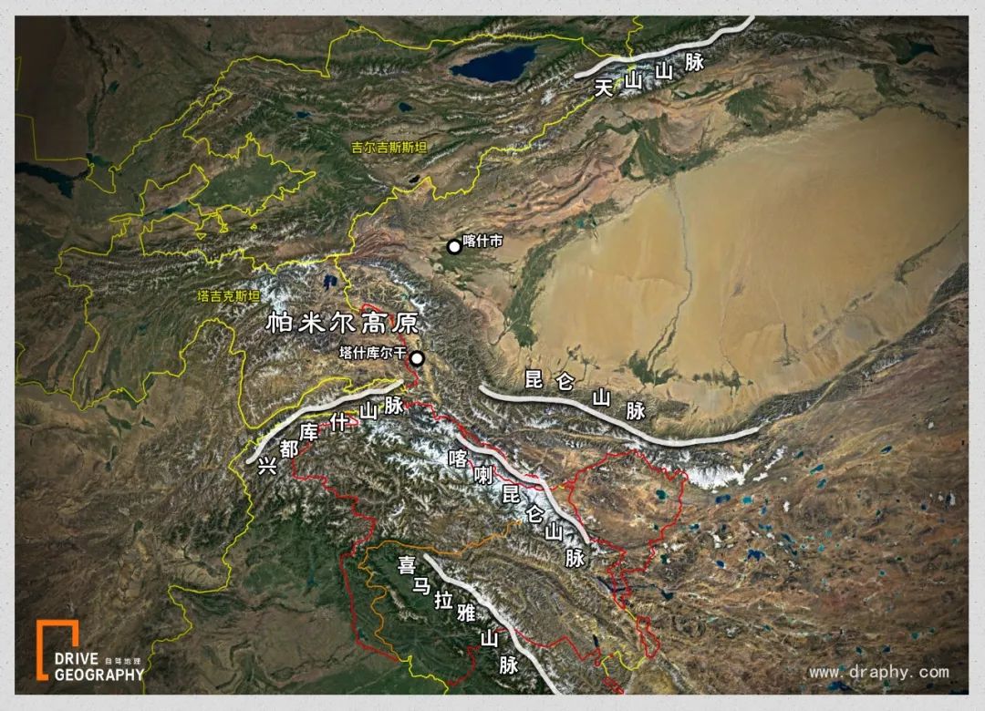
world famous five mountains
Himalayas , Kunlun ,
Karakoram , Hindu Kush , Tian Shan
all extend from here to all directions
form a giant mountain knot
So there is this Tajik proverb:
“A man’s navel is on his belly, but the world’s navel is on Pamir.”
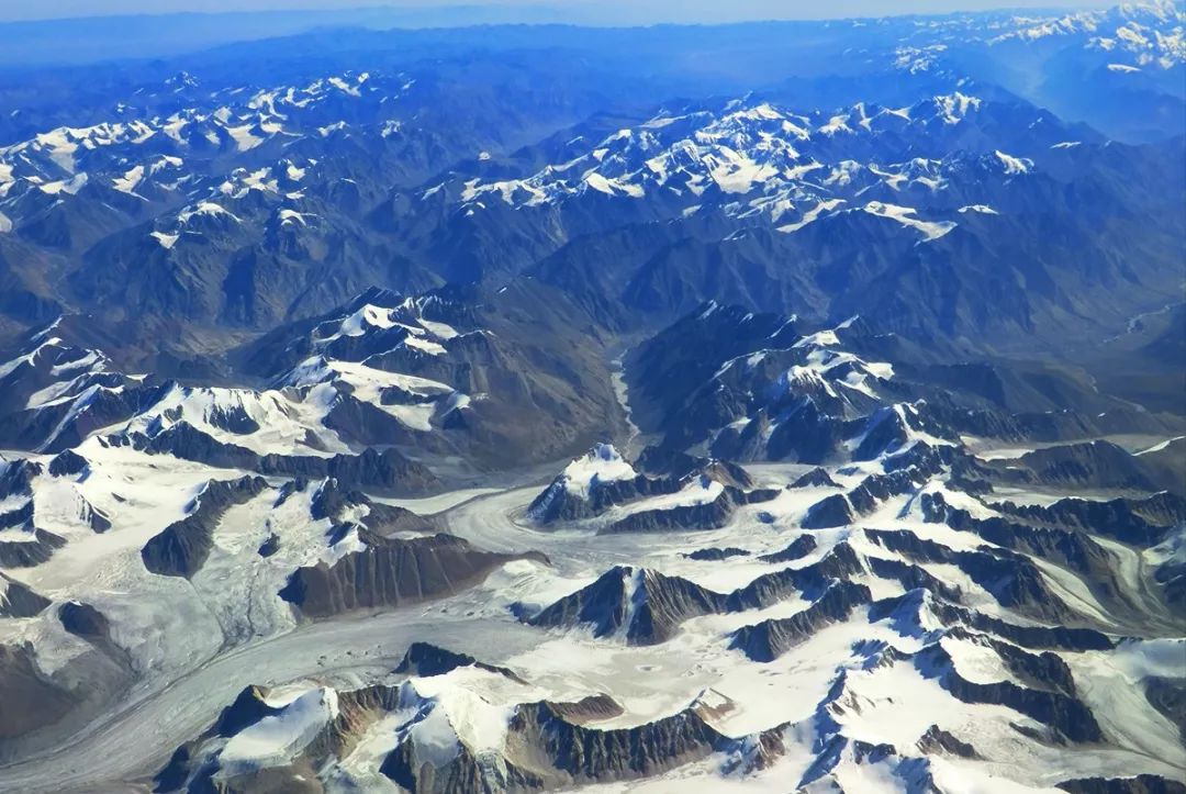
▼ Here is the Pamirs
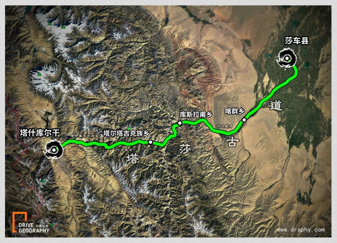
The nearly 200-kilometer Tasha Trail
Just lingering on the remote and desolate Pamir Plateau
Kathun
It was originally called “Katzun Ancient Road”
Later, when Mr. Feng Qiyong was inspecting
Take the prefixes of Ta County and Shache County
Tasha Trail
The name replaces
The original name survives
▼ The general route of Tasha Ancient Road, pictured by “Self-driving Geography”
but whatever the name
Since ancient times it has been
An important passage from Shache to Central Asia
about a thousand years ago
Xuanzang returns to the east after learning Buddhist scriptures
Take the Pamirs back to Chang’an
This is the ancient Tasha trail
▼ Still photo of the movie “Xuanzang of the Tang Dynasty”

AD 628
Xuanzang travels west alone to learn Buddhist scriptures
Traveling through the ancient silk road
step into ancient india
It took about 19 years from departure to return to Chang’an
After obtaining the scriptures
In order to fulfill the promise with Qu Wentai, the king of Gaochang:
Stayed in Gaochang State for three years to promote the Dharma
He chose to take a risky shortcut
Over the Pamirs
Back to the Tarim Basin
▼ Xuanzang’s general route to the west
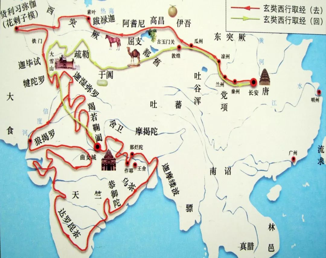
According to Xuanzang records
“From then on, go down to the east hill of Congling Ridge, climb up Weiling Ridge and cross the cave valley,
The stream path is dangerous and windy and snowy,
Travel more than 800 li out of Congling to the country of Wuchao. “
(“Congling” refers to the Pamirs, and “Wujiao” refers to today’s Shache)
sadly
AD 640
Gaochang Kingdom was destroyed by the Tang Dynasty
Qu Wentai also died in this year
From then on, there will be no Gaochang Kingdom in the world
Ju Wentai
▼ Visiting the eminent monk’s place, the picture is taken by the photographer to sneak away from the old horse
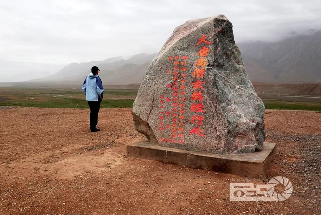
And this dangerous Tasha Trail
Not much has changed until today
Still meandering in the Karakoram Mountains
In the valley between the Yarkand River
It is still a shortcut from Shache to Central Asia
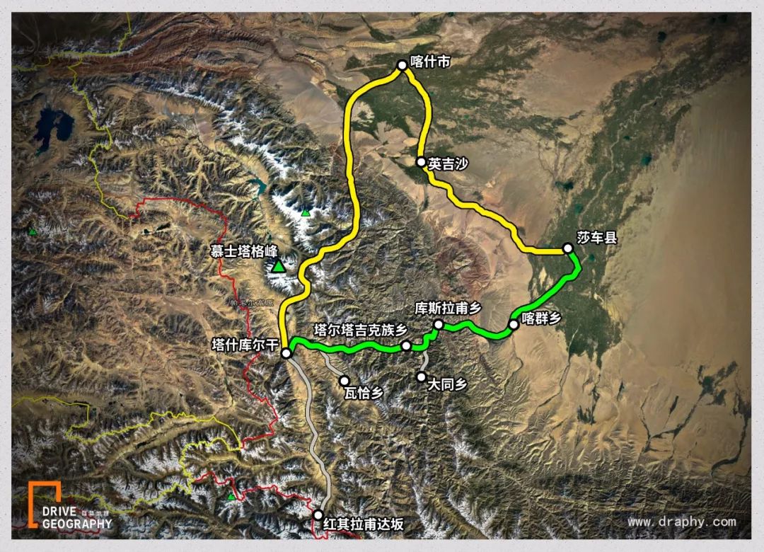
Return to Kashgar from Hongqi Lapp Port and then to Shache
nearly 600 kilometers to go
And take this ancient road through the mountains from the northern end of Taxian County
300 kilometers to go
Mileage cut in half!
▼ The yellow line is the self-driving route of Hongqi Lapu bypassing Kashgar and then going to Shache, and the green line is the Tasha Ancient Road, pictured by “Self-driving Geography”
2.
Tasha Trail, the Road of the Brave
officially called the road
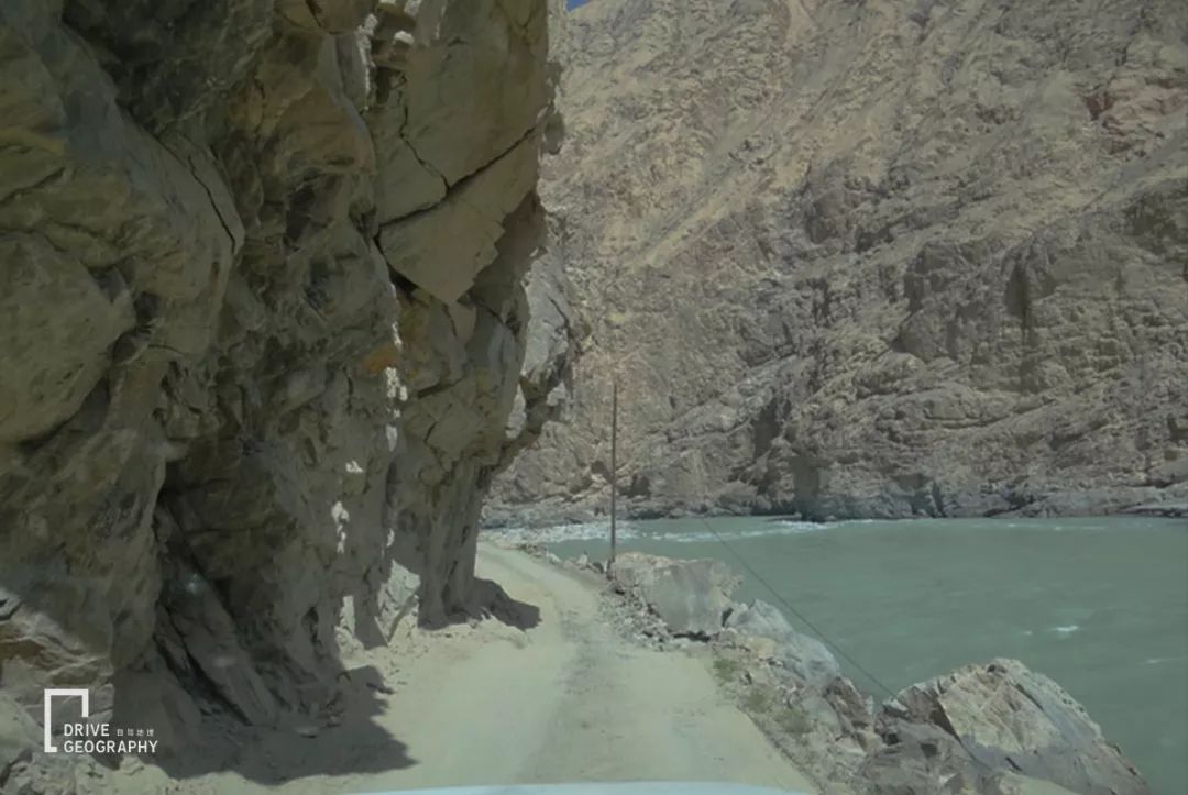
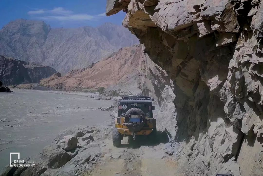
but it digs at the foot of the mountain
Most roads don’t have guardrails
▼ Picture by the photographer watching the sea and listening to the waves
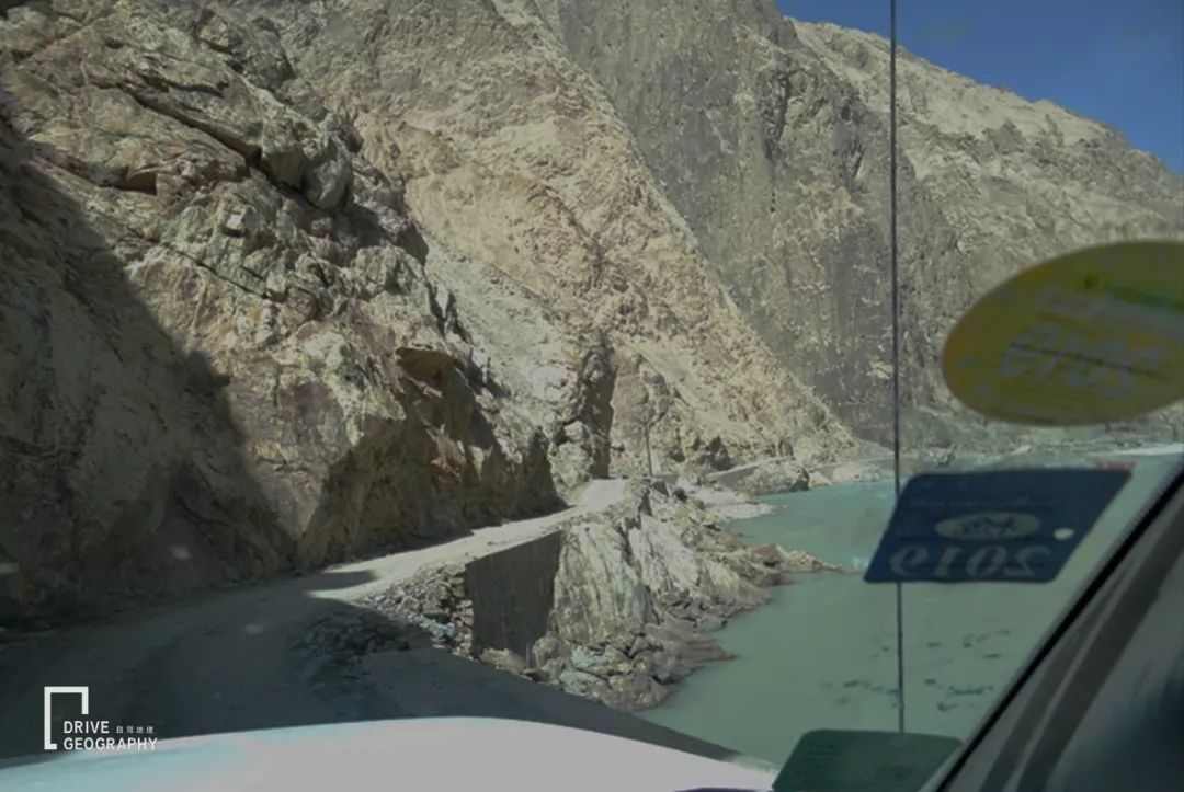
Almost the width of a car
Many people who passed by complained
“Where is the road here? It’s obviously a natural danger!”
▼ It is a bit difficult to get a car, picture by VIP member Nobita
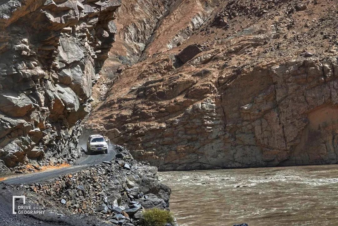
As soon as I set foot on this ancient road
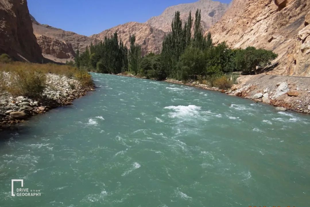
Along the way there is the Taxkur Gan River
go further back
was replaced by the Yarkant River
▼ Yarqiang River, picture by photographer watching the sea and listening to the waves
▼ Picture by VIP member Nobita
The danger of the Tasha Trail lies in
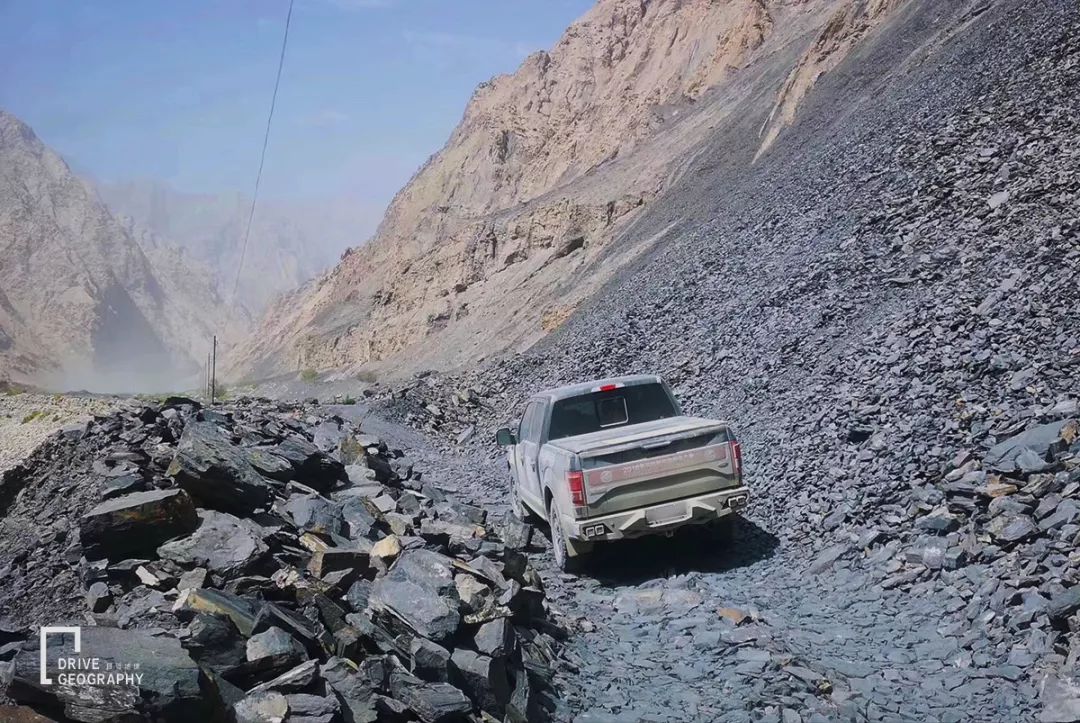
fragile geological environment
Even though asphalt roads have been paved in recent years
But there are still some sections
full of gravel, broken
Completely with traces of original excavation
▼ Picture by VIP member Watchman
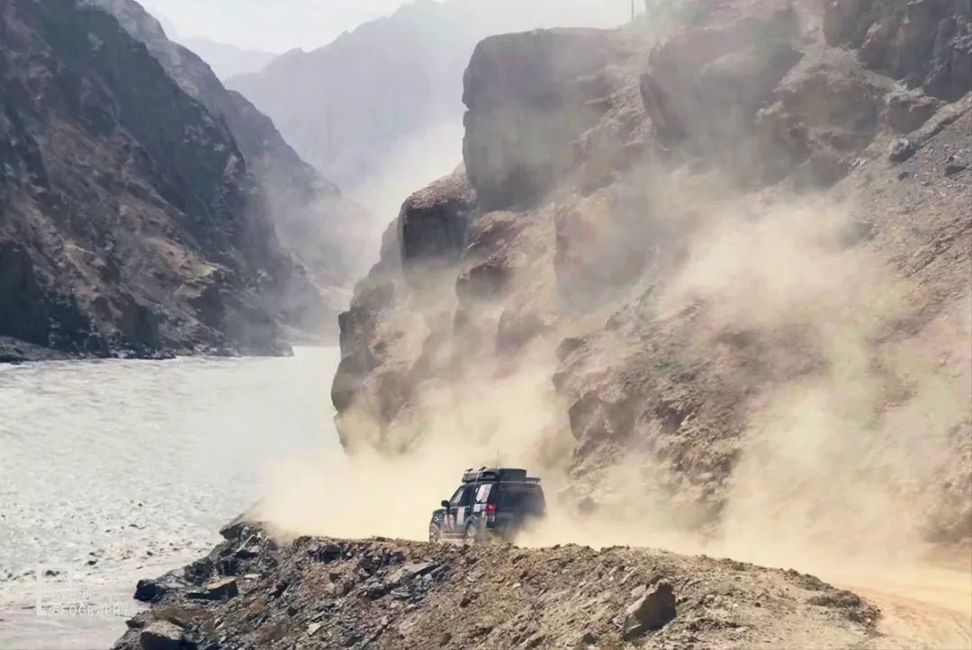
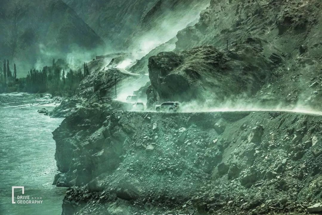
On one side is the wild Yarkand River
On one side is the steep Karakoram Mountains
Huge rocks hanging overhead
It can be unnerving when passing by
▼ Picture by the photographer watching the sea and listening to the waves
The road destroyed by landslides all the year round
riddled with holes
Repaired and dilapidated
▼ Picture by VIP member Watchman
▼ Picture by VIP member Nobita
ever drove by
The old driver of the Chinese border
Walking this road is also covered with sweat
Pray that the tires will not be scratched all the way
Concentrate on driving
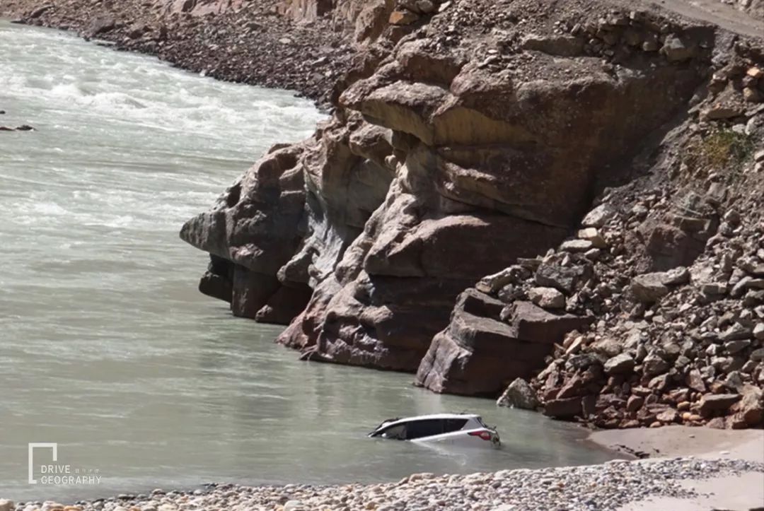
For fear of accidentally falling into the Yarkand River
▼ The car that fell into the river, I hope people can escape safely, picture by photographer Guanhai Tingtao
▼ Even the hook machine was not spared
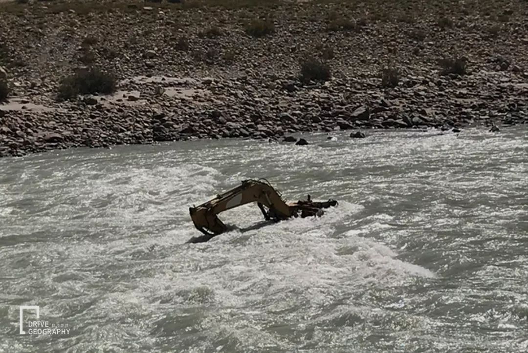
It’s hard to imagine Master Xuanzang back then
How did they cross over with the power of humans and animals…
3.
There is a hole in the poor mountains and bad waters
It is said that the northern Xinjiang sees the scenery , and the southern Xinjiang sees the style
The charm of Tasha Trail lies in
Sometimes a hundred miles around is deserted, desolate and lonely
Sometimes flowing water, people live alone in a corner
▼ Tasha Ancient Road among the desolate mountains, pictured by VIP member Nobita
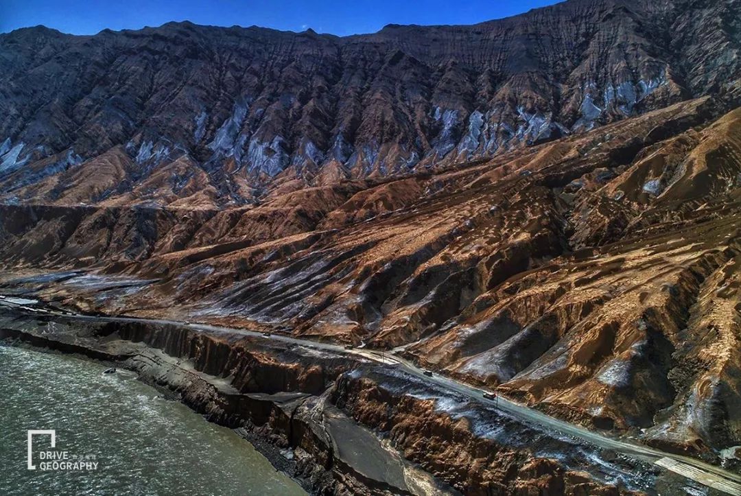
“May I ask where is the restaurant? The shepherd boy points to Xinghua Village”
Beautiful Taxkurgan River, Yarkant River
like a jumping ribbon
Stay with Tasha Trail
Nurturing countless beautiful “Xinghua Village”
▼ Xinghua, Datong Township, pictured by VIP member Dongzi
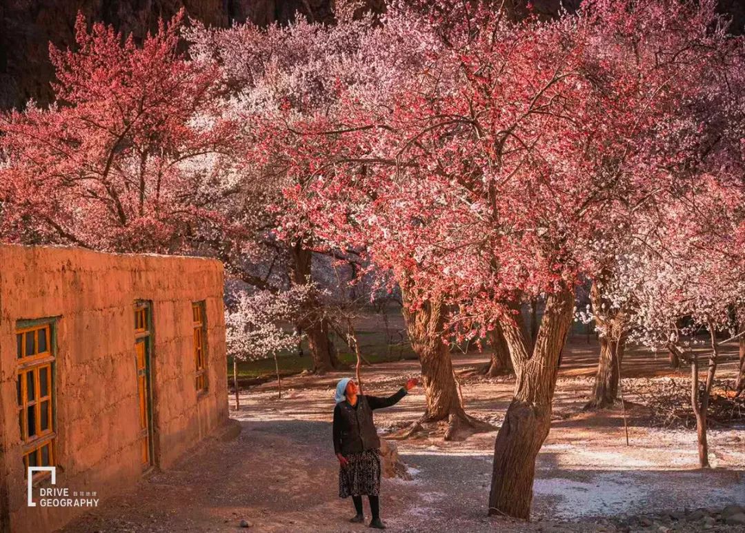
Almalek
One is located deep in the Kunlun Mountains
The ideal place to watch the apricot blossoms in Pamir
Simple, natural, without a little noise
into such a beautiful village
I feel very quiet inside
▼ Apricot Blossom Corridor in the Taxkorgan River Valley, pictured by photographer Nanzi
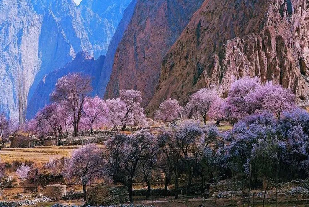
a place famous
It could be because of an article or a set of beautiful pictures
Springtime in Almalek surrounded by almond blossoms
walk into it
A century-old apricot tree in full bloom above the head
Falling petals underfoot
like an embroidered carpet
▼ The source of the picture is from the public account: Zebra Lake
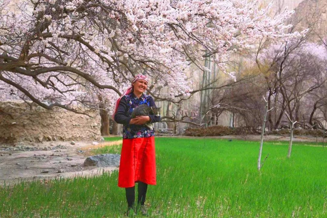
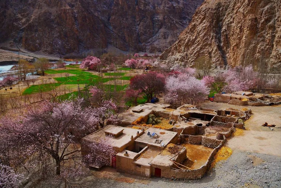
The houses under the apricot tree are almost all
Sheepfolds and cowsheds built with stones
and flat-roofed mud-walled houses
▼ Tajik traditional folk house, the picture comes from the official account: Zebra Lake
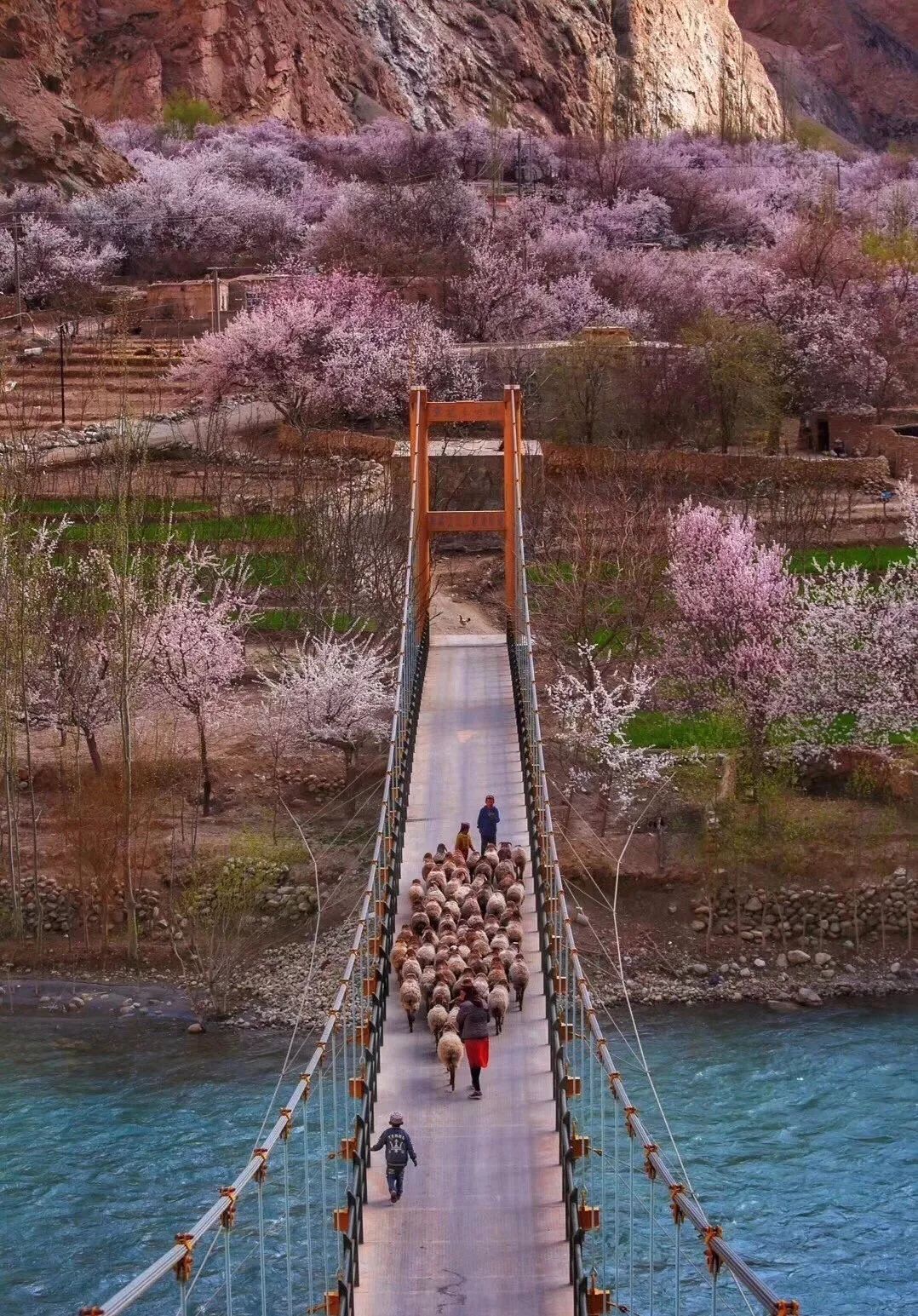
China’s only Caucasian ethnic group
Simple and kind Tajiks
working and farming here
The house looks like a chicken and a dog
▼ The source of the picture is from the public account: Zebra Lake
Thanks to the barrier of mountains
and the dangers of the road
Tajiks have multiplied here for generations
Live a life of self-sufficiency, away from distractions
young or old
When we meet each other, there must be a hand kiss
▼ Picture by member Luo Yuan
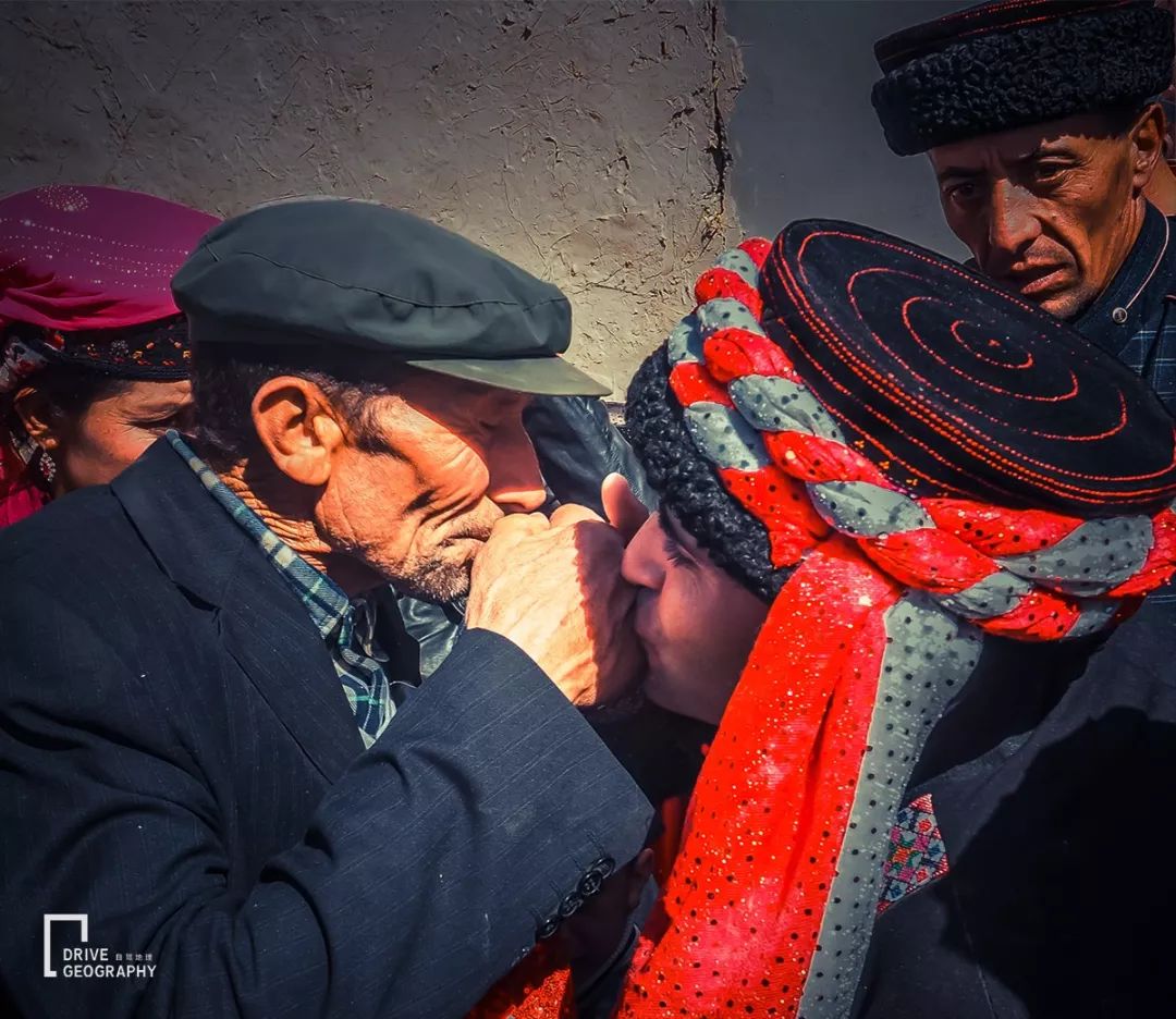
they meet strangers
warm and sincere
Whether you know it or not
will be invited to the house for tea and dinner
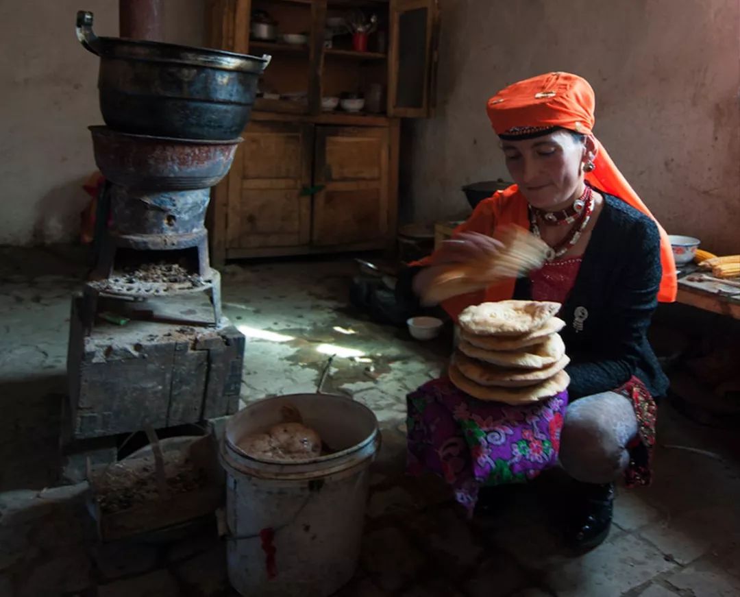
▼ Little brother, do you want a piece of naan? Picture by member Luo Yuan

On the harsh Pamirs
Naan for Tajiks
It is essential for three meals a day
Soak the upper half of the naan with milk tea
just a delicious meal
▼ Baking naan, picture by photographer Light and Shadow
In festive festivals such as weddings and Eid al-Adha
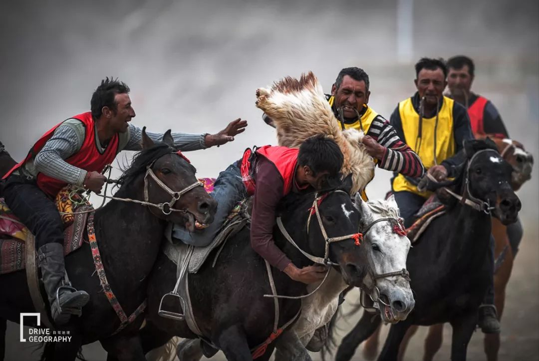
Tajiks also have a favorite sport
– holding a sheep
At festivals, when the cabaret is over
A goat is brought out to wait for the rider
As soon as the rider takes over the goat
Picking up the sheep has officially begun
The crowd of onlookers deliberately raised dust
Yelling and shouting, the atmosphere is extremely enthusiastic
▼ Picture by member Luo Yuan

Listen to the old man in the village say
Their ancestors, in order to avoid the disaster of war
Step by step into the Tasha Trail
Escape to the depths of the Kunlun Mountains
4.
Tasha Trail, off-road missions are about to disappear
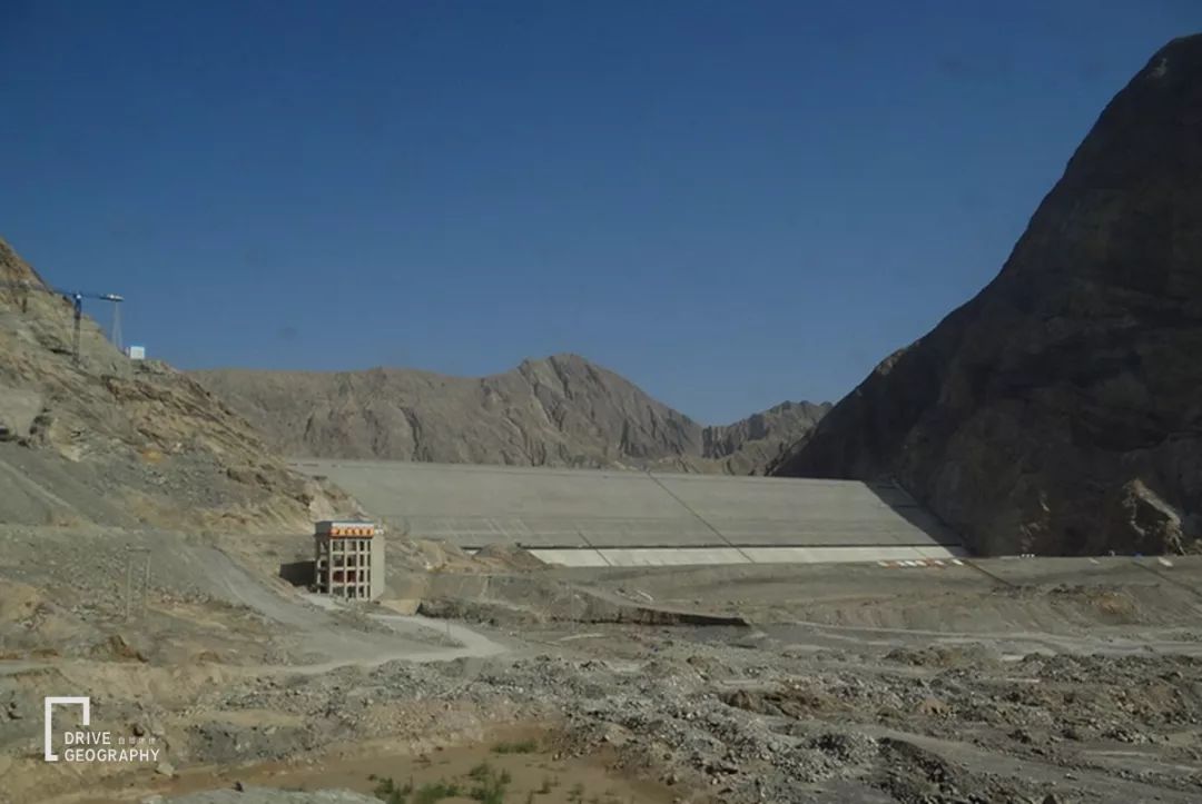
It is rumored that due to the construction of the reservoir
not long
The second half of the ancient road will sink to the bottom of the valley forever
Areas of hundreds of kilometers will be depopulated
▼ The dam is about to be built, picture by the photographer watching the sea and listening to the waves
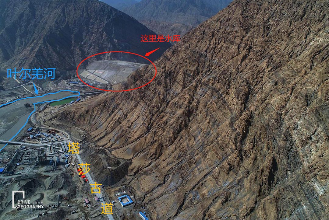
▼ Aerial photo of the dam, photo by VIP member Nobita
I learned from an insider
The Tasha Trail will not be submerged in its entirety
Only the road near the reservoir was flooded
And last year these sections
The asphalt road above the ancient road has been changed
pass through the tunnel
Depart from Ta County
The upper reaches of the Ta River are paved roads
The downstream is still a broken old road
At present, the ancient road is gradually being expanded into a secondary cement road
Temporarily closed
(It’s a different matter if you have acquaintances, shhh…)
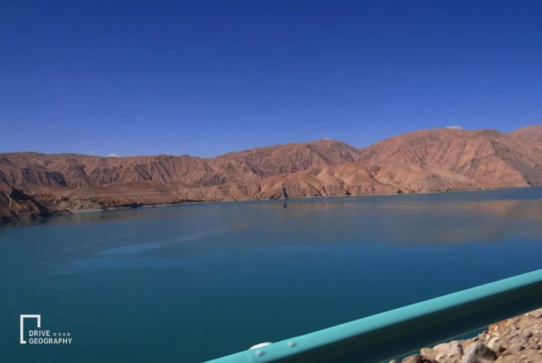
▼ The reservoir area has been formed, pictured by the photographer Guanhai Tingtao
That is to say
Although the Tasha Trail won’t be flooded
But still on the old path of Bingchacha
off-road life is disappearing
After the transformation, it will be a good tourist road…
-Part of the picture comes from the Internet-
Thank you brothers and sisters for the pictures!
This account is Netease News · Netease account “each has its own attitude” signing account


