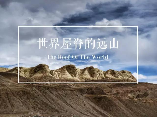
The world-renowned explorer Sven Hedin introduced Pamir in his book “Travel in the Inner Asia”:
Pamir is the most majestic mountain range in Central Asia. It is like many snow-covered giant mountains gathered together to form a huge knot, and from this it expands in all directions, forming the highest mountain in the world. The most majestic mountains.
To the northeast are the Tianshan Mountains, to the southeast are the Kunlun, Mustaq and Himalayas, and to the southwest are the Hindu Kush.
Therefore, this place has an appropriate name, the “roof of the world”.
According to the topographical characteristics, the Pamir Plateau is divided into two parts: east and west:
The terrain of East Pamir is relatively open and open, consisting of two snow-covered mountains in the northwest-southeast direction and a group of river valleys and lake basins.
The absolute height of the altitude is 5000-6000 meters.
West Pamir is composed of several roughly parallel northeast-southwest mountain valleys.
The terrain has a relatively large drop and is characterized by high mountains and deep valleys.
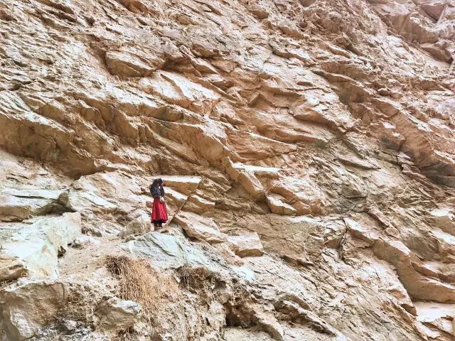
It has been a year since I settled in Taxkorgan County in the Pamir Plateau. According to my travels in this year, I found that the mountains in Pamir have different shapes and are full of strange things.
I used to live in Jiuzhaigou when I was young, and I am used to the lush and green mountains that change colors with the seasons.
After growing up, he developed a good impression of the seemingly desolate but magnificent mountain.
Climbing all the way from Kashgar, the altitude keeps rising,
The mountains are always with us.
I have been observing these mountains since the first time I came here. Although I am not an expert in geology, I have also developed a strong interest in them.
Next, from the perspective of a traveler,
Let me talk about these distant mountains on the roof of the world in my eyes.

Taxkorgan
Thank you
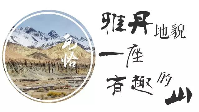
Starting from Kashgar, head towards the Pamir Plateau, passing through a large Uighur village, and after passing Oytak, you will see a red mountain appearing in front of you.
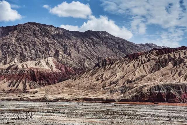
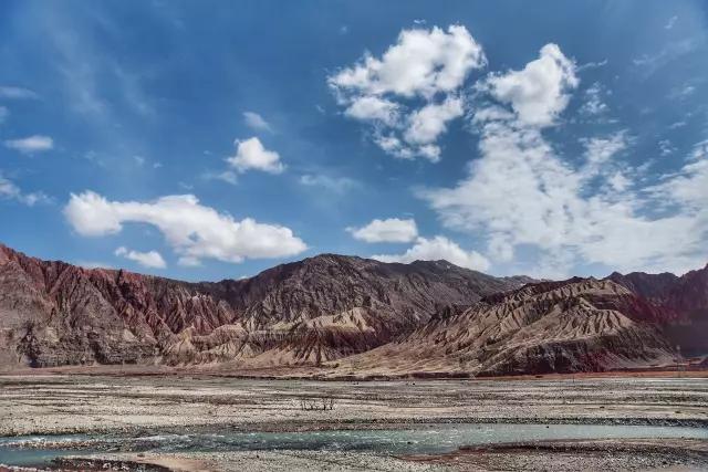
These mountains seem to rise from the alluvial river, clean and neat, without extra decoration, only layered with color.
Different shades of red, khaki, and brown, they are randomly arranged, soaked into these mountains, and attracted my attention.
The reason why the mountain is beautiful is because of these lines, as if thousands of rivers flowed through it, leaving deep and shallow grooves. These grooves have been baptized by time to form unique gullies.
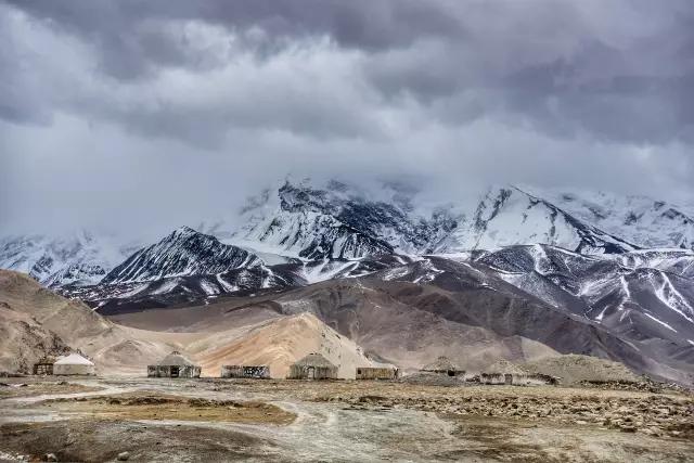
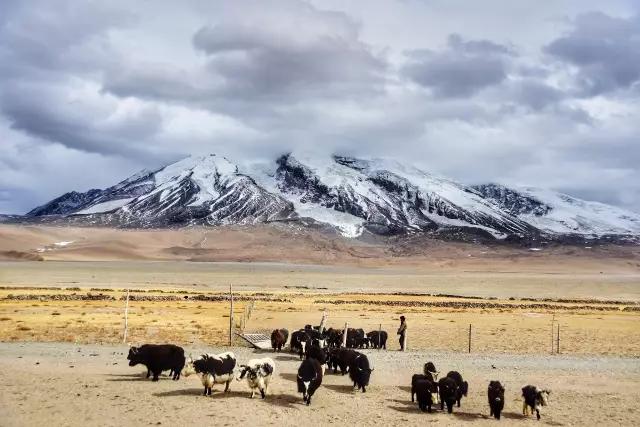
Continue to move forward, and the snow-capped mountains will stand in this barren mountain.
In Sichuan, the snow-capped mountains are surrounded by emerald green mountains. Even if there are no plants above the snow line, there are still clusters of trees on the mountains, and the valleys are even more lush.
But the snow-capped mountains of the Pamirs are in this barrenness. That white mountain looks a little abrupt against the backdrop of a sallow yellow.
As far as the eye can see, the color is so monotonous that it looks like a child who has no worries.
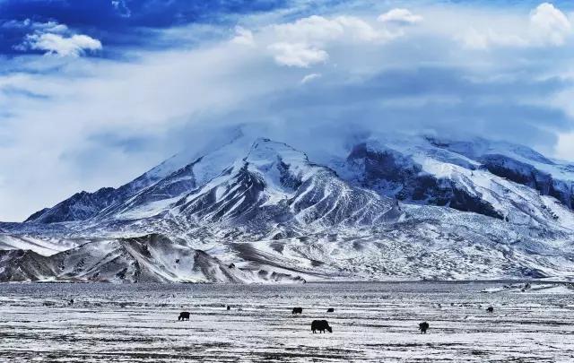
It wasn’t until we saw Gongger Peak, Gongger Jiubie Peak and Muztag that we saw the embellishment of the grassland below the mountain.
The local herdsmen call it Gongger Jiubie Peak, which means white hat. This string of snow-capped mountains is like their hats, standing side by side with Gongger Peak. Together with Muztag Peak in the south, they are called the three famous peaks of the East Pamirs.
However, when you see Muztag, you will be deceived by his round appearance. This is a mountain of more than 7,000 meters, which looks like…a steamed bun.

Vacha Township
waqia
Starting from Taxkorgan, follow the Tasha Ancient Road, pass the Xiabandi Reservoir, head towards Maeryang, cross the Reservoir Bridge, and arrive at Waqia Township.
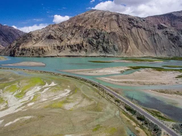
In addition to wind-eroded rock formations, there are several very large landslides along the way.
It can be vaguely seen that the former sheep trail is on the banks of the Taxkorgan River, looming among the steep mountains.
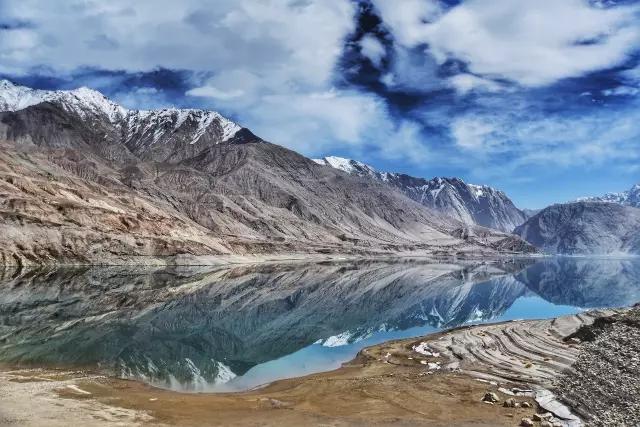
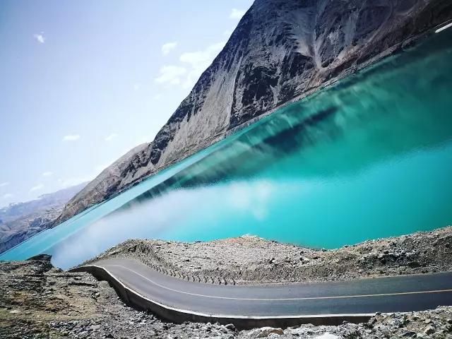
Every time I pass by, I will imagine the scene of people who used to walk this road. Tang Xuanzang, Marco Polo, Sven Hedin, and countless Tajik herdsmen, they just crossed mountains and mountains on that path.
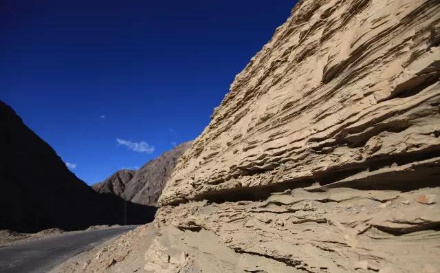
Even though the world has changed, those mountains have witnessed the people who passed by it.
So the mountain I saw was the same as what they saw.
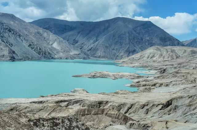
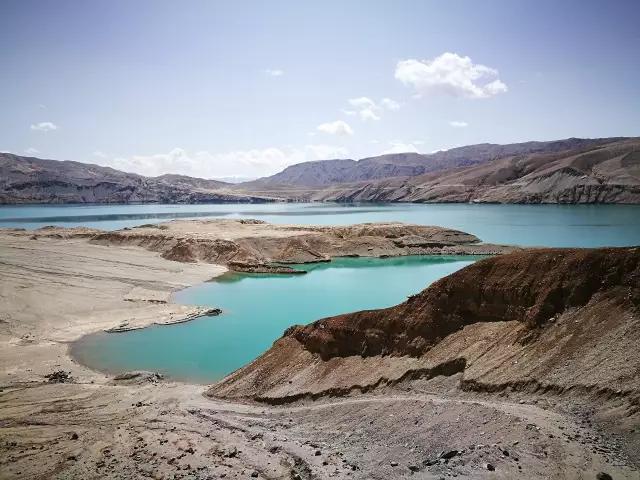
Xiabandi Reservoir is a water conservancy project approved by the State Council in 2001, and it took 6 years to complete.
In my opinion, it is more like a plateau lake, with the color of jasper, embedded in a small hill. The hills, like adornments wrapped around jeweled pendants, jut out into the lake on all sides and hold it tight.
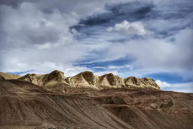
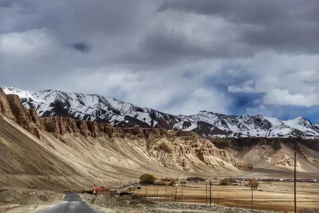
Waqia Township is located in a very open plain with an altitude of about 3,700 meters. The climate is cold and the winter is long.
The winding asphalt road runs through the desolate mountains, and several small oases are scattered here.
Still surrounded by monochromatic mountains. The Yardang landform is the main geological structure in this area. Walking through this area, there is often an illusion of being in Egypt.
The pointed hills are like earth-colored pyramids and a group of sphinxes, all of which are masterpieces of natural weathering.
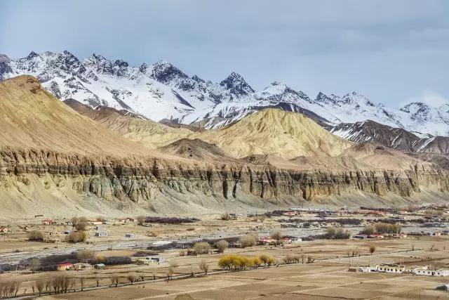
At sunset, climb up the hillside on the other side and look down at the village. The trees stretch out along the country road, and a magnificent mountain stands in the distance, and the snow-capped mountains farther away stand on these hills, layer upon layer. Illuminated by the setting sun.

Kukexiluke Township
Fuck Luke
Tasha Ancient Road is an ancient road from Taxkorgan to Shache.
There are many scattered villages in this section, Tajiks, Kirgiz and Uighurs are scattered here.
The whole journey is about 300 kilometers long.
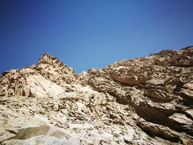
Pass the Xiabandi Reservoir again and walk into the canyon. The surrounding mountains are completely different from those in the direction of Waqia Township.
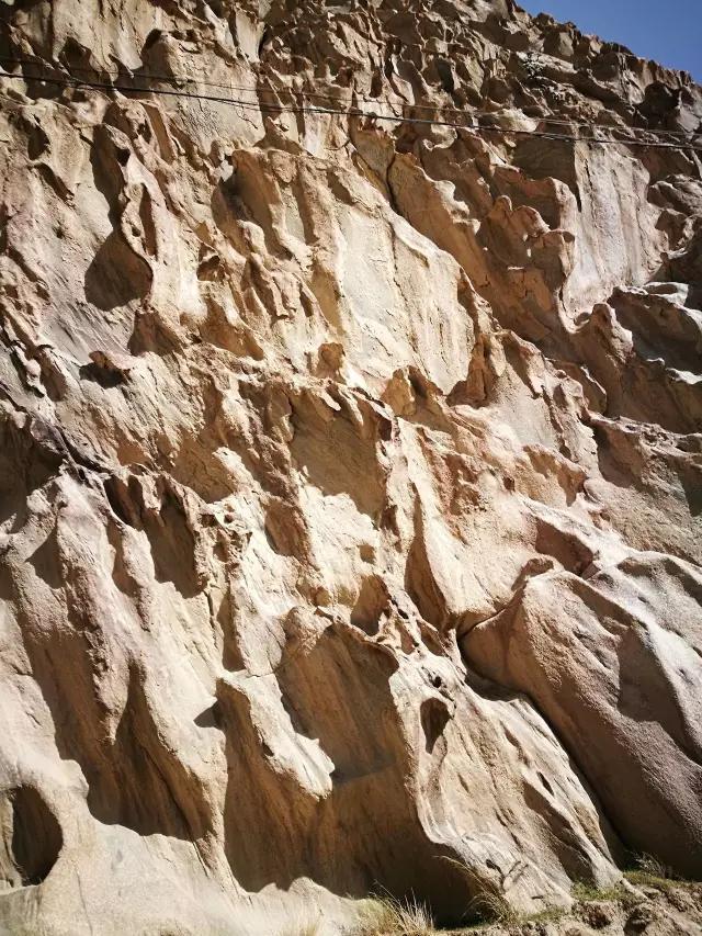
Some of these wind-eroded mountains are perforated, and some form grooves. The overall mountain is uneven, but the inside of the groove is as smooth as polished.
You can’t help but admire the power of the wind, how it looks like a fanatical artist, creating these treasures bit by bit with his hands.
It makes the hard rock look a little softer, as if playing with the dirt and kneading the shapes by hand.
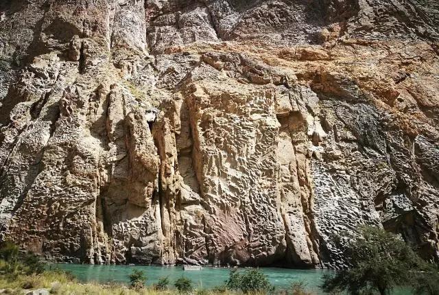
After careful observation, I found that there are some rocks of different sizes and shapes that look like written paper, and the lines on them look like words.
Such interesting mountains.

Pamir is a magical mountain with many scenery that I have never seen before.
Most of the landscapes are desolate, but if you look at them, you will feel that they have their own characteristics.
This is the charm of a place that can retain a person.
I am very lucky to have been chosen here.


